Øyeren

Øyeren
Øyeren
Nordre Oyeren Naturreservat 02.jpg
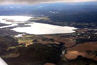
Geographische Lage Trøgstad, Spydeberg (Østfold); Fet, Rælingen, Enebakk (Akershus)
Zuflüsse Glomma
Abfluss Glomma
Daten
Koordinaten 59° 51′ 26″ N, 11° 9′ 48″ O59.85722222222211.163333333333101Koordinaten: 59° 51′ 26″ N, 11° 9′ 48″ O
Øyeren (Akershus)
Øyeren
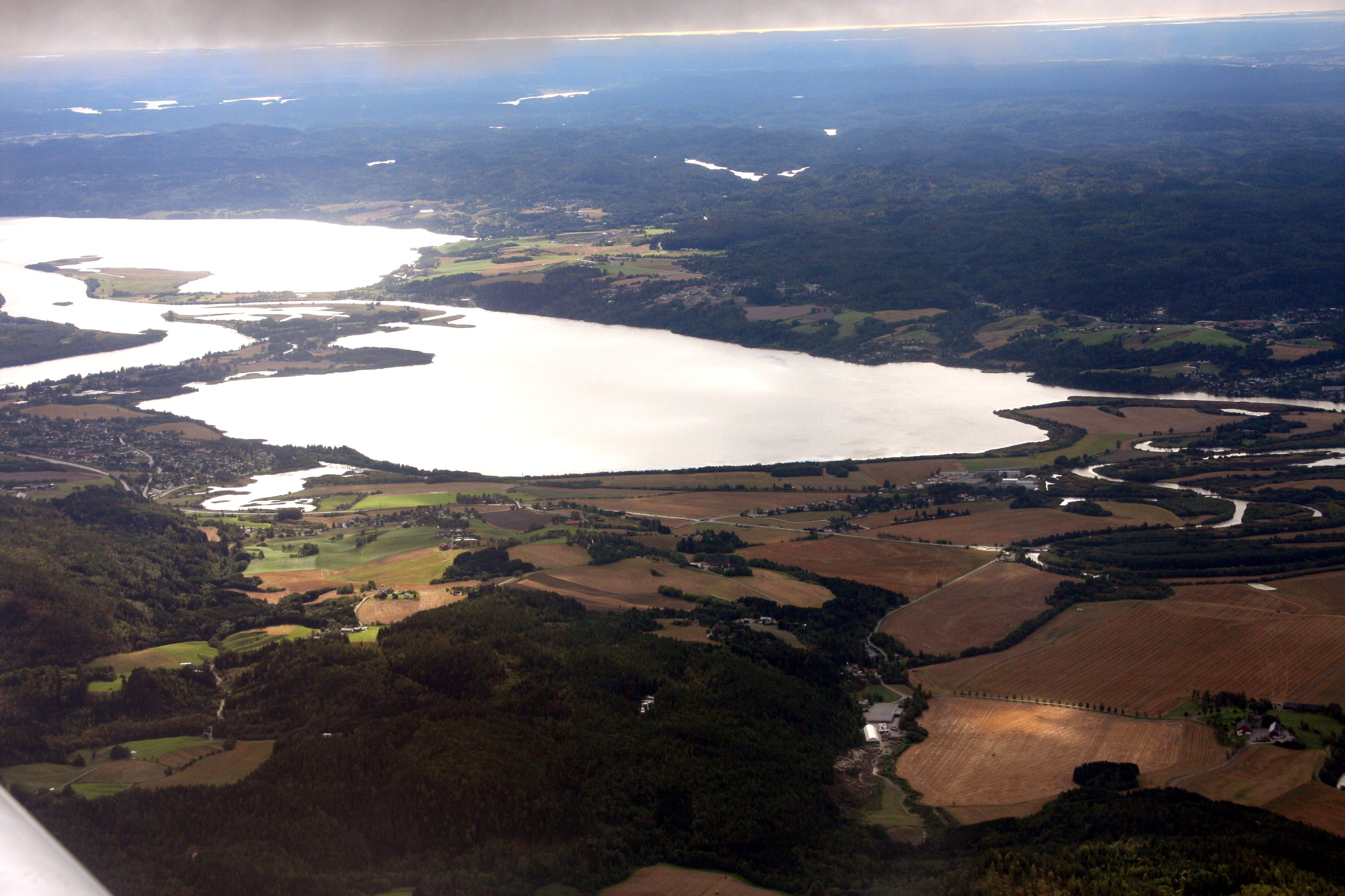
Höhe über Meeresspiegel 101 moh.
Fläche 84,74 km²f5
Umfang 165,47 kmf9
Maximale Tiefe 71 mf10

Der Øyeren ist der neuntgrößte Binnensee Norwegens. Er befindet sich in den Kommunen Enebakk, Fet und Rælingen in Akershus und Trøgstad und Spydeberg in Østfold. Zu- und Abfluss ist die Glomma. Zusammen mit den Flüssen Leira und Nitelva bildet die Glomma das größte Binnendelta am nördlichen Ende des Sees; Teile dieses Feuchtgebiets wurden zum Naturreservat erklärt (1975: Nordre Øyeren Naturreservat und 1992 Sørumsneset Naturreservat).

Fauna

24 verschiedene Fischarten wurden im Øyeren registriert, damit ist der Øyeren der See mit den meisten Arten in Norwegen. Vor dem Aufstau der Glomma fanden sich auch Aale und Lachse im Øyeren. Diese sind jetzt dort verschwunden.

Siehe auch

Weblinks


Wikimedia Foundation.

Игры ⚽ Нужно решить контрольную?

Schlagen Sie auch in anderen Wörterbüchern nach:

  • Öyeren — Øyeren Geographische Lage: Trøgstad, Spydeberg (Østfold); Fet, Rælingen, Enebakk (Akershus) Zuflüsse: Glomma Abflüsse: Glomma …   Deutsch Wikipedia

  • Øyeren — Map of Øyeren and surrounds Location …   Wikipedia

  • Øyeren — Sp Èjerenas Ap Øyeren L ež. ir g tė P Norvegijoje …   Pasaulio vietovardžiai. Internetinė duomenų bazė

  • Nitelva — at Nittedal Nitelva is a river which rises at Grua which runs down to Harestuvatnet in the southern part of Lunner municipality in Oppland. The river then flows southwards and ends at Øyeren. The river has at this point run for around 37 km, and… …   Wikipedia

  • Fet — Infobox Kommune name=Fet county=Akershus idnumber=0227 landscape=Romerike capital=Fetsund governor=Lisbet Lofthus Gabrielsen (Ap) governor as of=2005 arearank=347 area=176 arealand=137 areapercent=0.05 population as of=2004 populationrank=108… …   Wikipedia

  • Østmarka — is a forested area to the east of Oslo and part of the congregation of woodland areas known as Oslomarka. The area is situated within the municipalities Oslo, Lørenskog, Rælingen and Enebakk. Østmarka is delimited to the west by populated areas… …   Wikipedia

  • Fetsund — forms the center of the municipality Fet in the county of Akershus, Norway. The name comes from the way the area is, and Fet means where water meets grass . As for the sund part, it simply means strait, inlet . Accordingly, Fetsund is located at… …   Wikipedia

  • Glomma — Geobox|River name = Glomma native name = other name = Glåma category = etymology = Old Norse, Glaumr , from raumr : noise, racket nickname = image caption = Glomma at Solbergfoss power plant, Østfold country = Norway state = region = district =… …   Wikipedia

  • Mjøsa — View northwards from Minnesund, Eidsvoll Location Akershus, Hedmark, Oppland Coordinates …   Wikipedia

  • Østensjøvannet — photo: Hans Petter Fjeld Location Oslo Coordinates …   Wikipedia

Share the article and excerpts

Direct link
Do a right-click on the link above
and select “Copy Link”