Bubiyan

Bubiyan

Vorlage:Infobox Insel/Wartung/Bild fehltVorlage:Infobox Insel/Wartung/Höhe fehlt

Bubiyan
Gewässer Persischer Golf
Geographische Lage 29° 44′ N, 48° 12′ O29.73333333333348.2Koordinaten: 29° 44′ N, 48° 12′ O
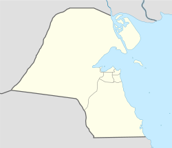
Bubiyan (Kuwait)
Bubiyan
Länge 40 km
Breite 24 km
Fläche 863 km²dep1
Einwohner (unbewohnt)

Bubiyan (arabisch ‏جزيرة بوبيان‎, DMG Ǧazīrat Būbiyān) ist mit einer Fläche von 863 km² die größte Insel vor der Küste Kuwaits. Sie befindet sich im nordöstlichsten Bereich des Persischen Golfes. Die flache, unwirtliche Insel ist ein unbewohntes militärisches Sperrgebiet. Bubiyan ist Teil des kuwaitischen Gouvernorats al-Dschahra.

Bubiyan ist die größte Insel einer Gruppe von acht Eilanden im Mündungsgebiet des Schatt al-Arab. Zwischen Bubiyan und dem irakischen Festland im Nordosten erstreckt sich der Chaur Abd Allah / ‏خور عبد الله‎, zwischen Bubiyan und dem kuwaitischen Festland im Südwesten der Chaur as-Sabiya / ‏خور الصبية‎. Der letztgenannte Kanal setzt sich bis in den Norden der Insel fort, wo er Bubiyan von der Nachbarinsel al-Warba trennt. 5,4 Kilometer nördlich des südlichsten Punktes der Insel am Ra's al-Barscha ist Bubiyan durch eine 2,38 km lange Balkenbrücke mit dem kuwaitischen Festland verbunden. Es existieren Pläne, auf der Insel eine Hafenanlage mit Eisenbahnanschluss zu errichten.

Bis 1994 war Bubiyan aufgrund seiner strategisch bedeutsamen Lage zwischen Kuwait und dem Irak umstritten. Im Zweiten Golfkrieg wurde die Brücke schwer beschädigt, anschließend jedoch restauriert. 1994 stimmte der Irak dem Grenzziehungsvorschlag des UN-Sicherheitsrats zu.

Weblinks


Wikimedia Foundation.

Игры ⚽ Нужно сделать НИР?

Schlagen Sie auch in anderen Wörterbüchern nach:

  • Bubiyan — Isla Bubiyan جزيرة بوبيان Localización País  Kuwait Coordenadas …   Wikipedia Español

  • Bubiyan — 29°47′N 48°11′E / 29.783, 48.183 …   Wikipédia en Français

  • Būbiyān — ▪ island, Kuwait       island of Kuwait, located at the head of the Persian Gulf. It is the largest of a group of eight islands situated just southwest of the mouth of the Shaṭṭ Al ʿArab, which divides Iraq and Iran. Like all of the group except… …   Universalium

  • Bubiyan Island — ( ar. جزيرة بوبيان) is the largest island in the Kuwaiti coastal island chain with an area of 863 km². It is separated from the mainland in the northeast by Khawr Abd Allah and from the mainland in the southwest by Khawr as Sabiyah . The latter… …   Wikipedia

  • Jazirat Bubiyan — is the largest of the several Kuwait islands that lie on the northern tip of the Persian Gulf. It is approximately 2 miles off Kuwait s mainland. [cite web|url=http://land.worldcitydb.com/jazirat bubiyan 493857.html|title=Jazirat Bubiyan World… …   Wikipedia

  • Kuwait — Infobox Country native name = دولة الكويت Dawlat al Kuwayt conventional long name = State of Kuwait common name = Kuwait symbol type = Coat of arms national anthem = Al Nasheed Al Watani official languages = Arabic demonym = Kuwaiti capital =… …   Wikipedia

  • Iraq — /i rak , i rahk /, n. a republic in SW Asia, N of Saudi Arabia and W of Iran, centering in the Tigris Euphrates basin of Mesopotamia. 22,219,289; 172,000 sq. mi. (445,480 sq. km). Cap.: Baghdad. Also, Irak. * * * Iraq Introduction Iraq Background …   Universalium

  • Ports du Koweït — Image satellite du Koweït en 2001. L urbanisation et l industrialisation du territoire le long des côtes sud de cet État ressort nettement sur cette photo. Les sept principaux ports du Koweït sont disposés sur la moitié sud des 499 km de… …   Wikipédia en Français

  • Iraqi Republican Guard — Infobox Military Unit unit name= Iraqi Republican Guard caption=Republican Guard Forces Command insignia dates= country= Iraq allegiance= branch= type= role= size= command structure= garrison= garrison label= nickname= patron= motto= colors= Red… …   Wikipedia

  • Madinat al-Hareer — Burj Mubarak al Kabir Artist s Rendition General information Type Mixed Location …   Wikipedia

Share the article and excerpts

Direct link
Do a right-click on the link above
and select “Copy Link”