Buiríos Uí Chéin

Buiríos Uí Chéin

52.991627777778-8.12554444444447Koordinaten: 52° 59′ N, 8° 8′ W

Borrisokane (Irland)
DEC
Borrisokane
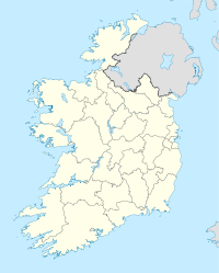
Borrisokane
Borrisokane auf der Karte von Irland

Borrisokane (irisch Buiríos Uí Chéin) ist ein Ort im Norden der Grafschaft (county) Tipperary in Irland.

Der Ort hatte 2006 etwa 1.145 Einwohner. Er liegt an der N52 road/N65 road zwischen Nenagh und Portumna und der N52 zwischen Nenagh und Birr. Borrisokane ist nur 12 km von Lough Derg entfernt.

Weblinks

Webpräsenz


Wikimedia Foundation.

Игры ⚽ Нужна курсовая?

Schlagen Sie auch in anderen Wörterbüchern nach:

  • Боррайсокен — Деревня Ирландии Боррайсокен англ. Borrisokane, ирл. Buiríos Uí Chéin Страна …   Википедия

  • County Tipperary — Contae Thiobraid Árann Coat of arms …   Wikipedia

  • Borrisokane — ( Buiríos Uí Chéin in Irish) is a town in north County Tipperary, Ireland. In 2006 it had a population of approximately 1,145. It is situated on the N52/N62 National secondary road between Nenagh and Portumna and the N52 between Nenagh and Birr.… …   Wikipedia

  • Borrisokane — 52.991627777778 8.1255444444444 Koordinaten: 52° 59′ N, 8° 8′ W …   Deutsch Wikipedia

  • Ormond Lower — (Irish: Urumhain Íochtarach) is one of the baronies of Ireland, an historical geographical unit of land. It is one of 14 baronies in the traditional county of Tipperary between the baronies of Ormond Upper to the south east (whose chief town is… …   Wikipedia

Share the article and excerpts

Direct link
Do a right-click on the link above
and select “Copy Link”