Alderley Edge

Alderley Edge
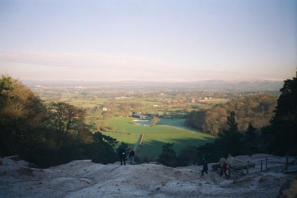
Alderley Edge
Blick vom Stormy Point
Koordinaten 53° 18′ N, 2° 14′ W53.303663888889-2.2363027777778Koordinaten: 53° 18′ N, 2° 14′ W
Alderley Edge (England)
Alderley Edge
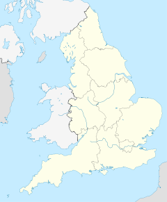
Alderley Edge
Bevölkerung 4.408 (Stand: 2009)
Verwaltung
Post town ALDERLEY EDGE
Postleitzahlen­abschnitt SK9
Vorwahl 01625
Landesteil England
Region North West England
Shire county Cheshire
Website: www.cheshireeast.gov.uk

Alderley Edge ist ein Civil parish in Cheshire ca. 19 km südlich von Manchesters. Die Gemeinde hat 4409 Einwohner (Stand 2001)[1].

Geschichte

Im 13. Jahrhundert wird der damalige Ortsname Chorlegh (später: Chorley) nördlich von Nether Alderley erstmals erwähnt. Vom späten 17. Jahrhundert bis zum frühen 20. Jahrhundert findet in der Region Kupferabbau statt. Ein Fund 564 römischer Münzen datiert auf die Zeit zwischen 317 und 338 aus dem Jahr 1995 legt den Schluß nahe, dass auch schon früher hier Bergbau betrieben wurde.

Der Name Alderley Edge stammt jedoch erst aus dem Jahr 1880, als die Manchester and Birmingham Railway zur Vermeidung mit nördlich von Manchester gelegenen Chorley (Lancashire) den Bahnhof Alderley Edge Railway Station taufte. Der Bezug zum Namen Edge stammt dabei aus einer Sandsteinformation des Trias, die zur Legendenbildung taugt. So bezieht sich etwa Alan Garner in seinem Stück The Moon of Gomrath auf das Bergwerk und in The Weirdstone of Brisingamen auf einen magischen Stein.

Zudem soll im frühen 18. Jahrhundert Merlin einen Farmer der Gegend in eine Höhle mit den schlafenden Gefährten König Artus geführt haben

Persönlichkeiten

Alderley Edge war und ist beliebter Wohnort vor den Toren Manchesters

Einzelnachweise

  1. 2001 Parish census details

Wikimedia Foundation.

Игры ⚽ Нужна курсовая?

Schlagen Sie auch in anderen Wörterbüchern nach:

  • Alderley Edge — infobox UK place official name= Alderley Edge latitude= 53.303 longitude= 2.236 population = 4,408, [http://www.macclesfield.gov.uk/standardpage.asp?pageid=10283 Borough of Macclesfield electoral ward census details] ] 4,409 [http://neighbourhood …   Wikipedia

  • Alderley Edge — Original name in latin Alderley Edge Name in other language State code GB Continent/City Europe/London longitude 53.30393 latitude 2.23773 altitude 87 Population 4408 Date 2011 03 03 …   Cities with a population over 1000 database

  • Alderley Edge Cricket Club — is an amateur cricket club based at Alderley Edge in Cheshire. The club s first team plays in the Cheshire County Cricket League, which is one of the ECB Premier Leagues that are the highest level of the amateur, recreational sport in England and …   Wikipedia

  • Alderley Edge railway station — Infobox UK station name = Alderley Edge other name= code = ALD caption = Southward view from the Crewe bound platform. manager = Northern Rail locale = Alderley Edge borough = Macclesfield usage0405 = 0.108 usage0506 = 0.108 usage0607 = 0.091… …   Wikipedia

  • Geology of Alderley Edge — Infobox Mountain Name = Alderley Edge Photo = Stormy Point 1993.jpg Caption = Stormy Point Elevation = 183 m (600 ft) Location = Cheshire, ENG Range = Prominence = Coordinates = Topographic OS Landranger 118 Grid ref UK = SJ870760 Grid ref… …   Wikipedia

  • St Philip's Church, Alderley Edge — St Philip s Church, Alderley Edge, from the south …   Wikipedia

  • Moss Lane, Alderley Edge — Moss Lane Ground information Location Alderley Edge, Cheshire Establishment 1961 (first recorded match) Domestic team information Cheshire (1973 1981 2000 present) Lancashire …   Wikipedia

  • Alderley Edge (Cheshire) —    A rocky outcrop near Macclesfield, honeycombed with old mining tunnels. A farmer was once stopped there by a wizard, who insisted on buying his white mare, and led him through huge iron gates inside the rock, where he saw many horses and… …   A Dictionary of English folklore

  • Alderley — could be*Alderley, Gloucestershire, England *Alderley, Queensland, Australiaee also*Alderley Edge, Cheshire, England *Over Alderley *Nether Alderley …   Wikipedia

  • Edge — An edge in common usage denotes a sharp border of a (solid) object.cience and technology* Edge (graph theory), a line segment joining two nodes in a graph * Edge (geometry), a line segment joining two vertices in a polytope * Edge case, a problem …   Wikipedia

Share the article and excerpts

Direct link
Do a right-click on the link above
and select “Copy Link”