Antrim House

Antrim House
Antrim House

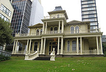
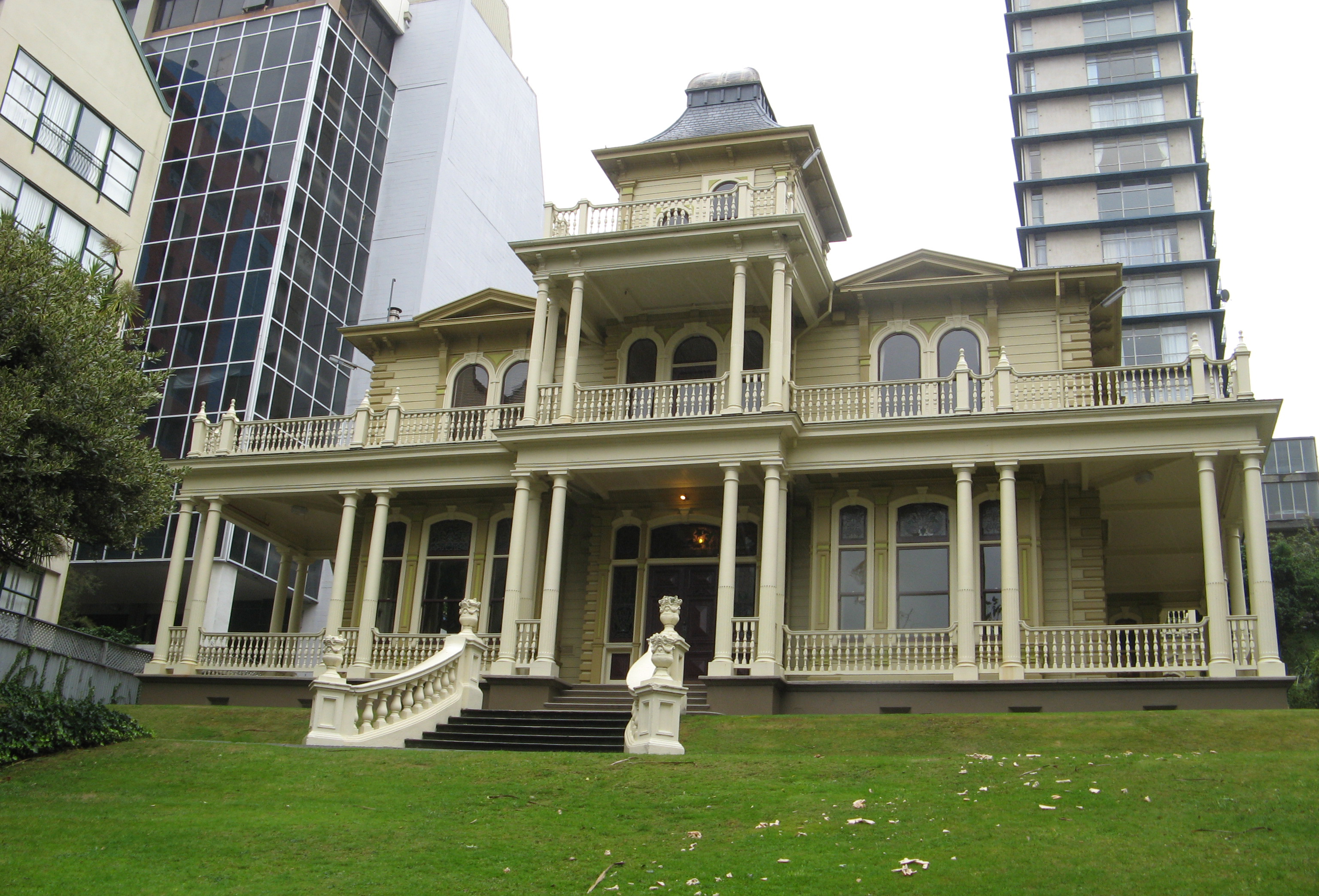
Antrim House ist ein historisches Bauwerk in der Boulcott Street in der neuseeländischen Hauptstadt Wellington. Das Haus wurde 1905 unter Leitung der Architekten Thomas Turnbull and Sons (William Turnbull für Robert Hannah, einen irischen Immigranten aus dem County Antrim erbaut. Es ist eine hölzerne Konstruktion aus Kauri und Kernholz des Totara auf einem Betonfundament. Antrim House ist ein gutes Beispiel des von edwardianischem und Italianate-Stil aus der Regierungszeit von Eduard VII. Das zweigeschossige Haus mit Turm und Mansardendach war einst eine eindrucksvolle Residenz eines reichen Geschäftsmannes auf einem großen Grundstück mit Garten und Nebengebäuden. Heute stehen Haus und kleinere Rasenflächen inmitten höherer moderner Gebäude.

Das Gebäude wurde am 26. November 1981 vom New Zealand Historic Places Trust als Denkmal der Kategorie I registriert. [1] Die neuseeländische Denkmalschutzorganisation hat hier ihren Sitz.

Einzelnachweise

  1. Antrim House (Englisch). Register of Historic Places. New Zealand Historic Places Trust. Abgerufen am 21. Dezember 2009.
-41.286927777778174.77386944444

Wikimedia Foundation.

Игры ⚽ Нужно сделать НИР?

Schlagen Sie auch in anderen Wörterbüchern nach:

  • Antrim House — Infobox building building name =Antrim House native building name= caption = former names = building type = architectural style = Edwardian structural system = location = Boulcott Street, Wellington, New Zealand owner = current tenants = New… …   Wikipedia

  • Antrim, County Antrim — Infobox UK place official name= Antrim irish name= Aontroim map type= Northern Ireland latitude= 54.7173 longitude= 6.2055 population= 20,001 (2001 Census) irish grid reference=J1588 unitary northern ireland= Antrim Borough country= Northern… …   Wikipedia

  • Antrim County (Parliament of Ireland constituency) — Coordinates: 54°42′40″N 6°11′46″W / 54.711°N 6.196°W / 54.711; 6.196 …   Wikipedia

  • Antrim (Parliament of Ireland constituency) — Parliament of Ireland former constituency infobox Name = Antrim Type = County Year = Post Union = Antrim (UK Parliament constituency)Antrim was a constituency represented in the Irish House of Commons until 1800. Following the Act of Union 1800… …   Wikipedia

  • Antrim (UK Parliament constituency) — For other constituencies of the same name, see Antrim (disambiguation). Antrim Former County constituency for the House of Commons 1801 (1801)–1885 (1885 …   Wikipedia

  • Antrim Borough (Northern Ireland Parliament constituency) — Northern Ireland Parliament constituency infobox Name = Antrim Type = County Start = 1929 End = 1973 EM = First past the postAntrim, sometimes known as Antrim Borough to distinguish it from the former constituency of the same name, was a single… …   Wikipedia

  • Antrim Borough (Parliament of Ireland constituency) — Parliament of Ireland former constituency infobox Name = Antrim Borough Type = Borough Year = 1666 Post Union = AbolishedAntrim Borough was a two member borough constituency used to elect members of the Parliament of Ireland.Boundaries and… …   Wikipedia

  • Antrim (Taneytown, Maryland) — Infobox nrhp | name =Antrim nrhp type = caption = nearest city= Taneytown, Maryland lat degrees = 39 lat minutes = 39 lat seconds = 15 lat direction = N long degrees = 77 long minutes = 10 long seconds = 29 long direction = W locmapin = Maryland… …   Wikipedia

  • House of McDonnell — The House of McDonnell is a traditional Irish pub in Ballycastle, Co. Antrim, Northern Ireland.Established in 1766, the pub is noted for the quality of the traditional Irish pub interior (Grade A listed), which has remained largely unchanged over …   Wikipedia

  • North Antrim (UK Parliament constituency) — For other constituencies of the same name, see North Antrim. Coordinates: 55°07′16″N 6°19′44″W / 55.121°N 6.329°W / 55.121; …   Wikipedia

Share the article and excerpts

Direct link
Do a right-click on the link above
and select “Copy Link”