Arnside Knott

Arnside Knott
54.189687-2.842505159
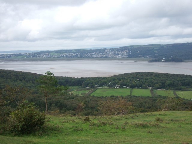
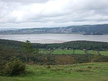
Blick vom Arnside Knott über die Müdung des River Kent in die Morecambe Bay in Richtung Grange-over-Sands

Arnside Knott ist ein Berg mit einer Gipfelhöhe von 159 m nahe Arnside, Cumbria, England.

Der Arnside Knott ist einer von zwei Bergen aus Kalkstein aus dem Karbon in der Arnside and Silverdale Area of Outstanding Natural Beauty und gehört dem National Trust.

Der Arnside Knott ist der niedrigste Marilyn in England.

Quelle

Weblinks


Wikimedia Foundation.

Игры ⚽ Поможем написать реферат

Schlagen Sie auch in anderen Wörterbüchern nach:

  • Arnside and Silverdale — Geobox Protected Area name = Arnside and Silverdale native name = other name = other name1 = category local = Area of Outstanding Natural Beauty category iucn = image size = image caption = The village of Arnside on the Kent estuary, with Arnside …   Wikipedia

  • Arnside and Silverdale — 54.18695 2.83433 Koordinaten: 54° 11′ 13″ N, 2° 50′ 4″ W …   Deutsch Wikipedia

  • Arnside — Infobox UK place country = England official name= Arnside latitude= 54.199 longitude= 2.832 civil parish= Arnside population = 2255 (1997) [http://www.cumbria.gov.uk/eLibrary/Content/Internet/536/642/37823161313.pdf] shire district= South… …   Wikipedia

  • Arnside — 54.199065 2.834004 Koordinaten: 54° 12′ N, 2° 50′ W …   Deutsch Wikipedia

  • List of Sites of Special Scientific Interest in Cumbria — This is a list of the Sites of Special Scientific Interest (SSSIs) in Cumbria. For other counties, see List of SSSIs by Area of Search.* Alston Shingle Banks * Annaside * Annaside And Gutterby Banks * Appleby Fells * Argill Woods And Pastures *… …   Wikipedia

  • High Raise (Langdale) — High Raise This view of High Raise from the cairn on Thunacar Knott shows that it is not the most spectacular of the Lake District mountains …   Wikipedia

  • Mellbreak — Mellbreak …   Wikipedia

  • Muncaster Fell — The view west from Hardknott Pass in upper Eskdale, toward Muncaster Fell. Elevation …   Wikipedia

  • Scafell Pike — viewed from Wastwater Elevation 978 m (3,209 ft) …   Wikipedia

  • Dent (fell) — Dent Cairn on the western slopes of Dent Elevation 352 m (1,155 ft) …   Wikipedia

Share the article and excerpts

Direct link
Do a right-click on the link above
and select “Copy Link”