Arnside and Silverdale

Arnside and Silverdale
54.18695-2.83433
Silverdale Moss mit Arnside Knott am rechten Bildrand in der Arnside and Silverdale AONB

Arnside and Silverdale ist eine Area of Outstanding Natural Beauty (AONB) in England. Das Gebiet liegt an der Grenze zwischen Lancashire und Cumbria am Rande der Morecambe Bay. Mit 75 km² ist es eine kleine AONB, die zwischen dem Mündungstrichter des River Kent, dem River Keer und der A6 liegt. Das Gebiet erhielt seinen Status 1972.

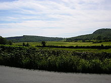
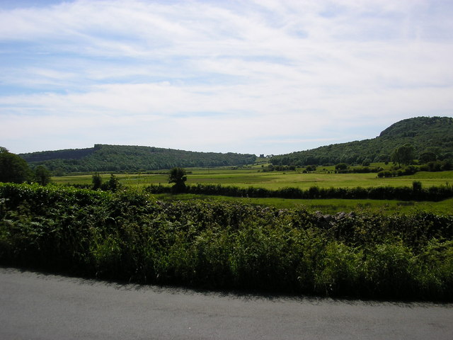
Arnside and Silverdale hat eine Reihe vonn niedrigen Hügeln aus Kalkstein aus dem Karbon wie dem Arnside Knott und dem Warton Crag. Zwischen den Hügeln liegt Grasland und kleine Gehölze aus Eschen, Eichen und Haselnuss. Die Küstenregion besitzt große Salzwiesen, die ständig vom River Kent verändert werden.

Das Leighton Moss Naturschutzgebiet ist im Besitz der RSPB und beherbergt viele Vögeln im größten Schilfgebiet im Nordwesten Englands. Es gibt auch 15 Site of Special Scientific Interest in Arndale and Silverdale, wo man seltene Schmetterlinge findet.

Die beiden größten Orte in dem Gebiet sind Arnside und Silverdale

Weblinks


Wikimedia Foundation.

Игры ⚽ Нужен реферат?

Schlagen Sie auch in anderen Wörterbüchern nach:

  • Arnside and Silverdale — Geobox Protected Area name = Arnside and Silverdale native name = other name = other name1 = category local = Area of Outstanding Natural Beauty category iucn = image size = image caption = The village of Arnside on the Kent estuary, with Arnside …   Wikipedia

  • Silverdale, Lancashire — Infobox UK place official name= Silverdale population= 1,545 (2001 Census) country= England os grid reference= SD465755 london distance= latitude= 54.16737 longitude= 2.821853 shire district= City of Lancaster shire county= Lancashire region=… …   Wikipedia

  • Arnside Knott — 54.189687 2.842505159 Koordinaten: 54° 11′ N, 2° 51′ W …   Deutsch Wikipedia

  • Arnside — Infobox UK place country = England official name= Arnside latitude= 54.199 longitude= 2.832 civil parish= Arnside population = 2255 (1997) [http://www.cumbria.gov.uk/eLibrary/Content/Internet/536/642/37823161313.pdf] shire district= South… …   Wikipedia

  • Arnside — 54.199065 2.834004 Koordinaten: 54° 12′ N, 2° 50′ W …   Deutsch Wikipedia

  • Silverdale (Lancashire) — 54.167 2.827 Koordinaten: 54° 10′ N, 2° 50′ W …   Deutsch Wikipedia

  • Ulverston and Lancaster Railway — The “Ulverstone” [The old name “Ulverstone” was still used in legal documents after it had been superseded by “Ulverston” in common usage. See Andrews (1966)] and Lancaster Railway Company was short lived as a business but the line that it built… …   Wikipedia

  • Cranborne Chase and West Wiltshire Downs — Coordinates: 50°57′41″N 2°02′39″W / 50.96142°N 2.04409°W / 50.96142; 2.04409 …   Wikipedia

  • Lancashire — For other uses, see Lancashire (disambiguation). Lancashire Flag of Lancashire[1] …   Wikipedia

  • Area of Outstanding Natural Beauty — A map of all AONBs An Area of Outstanding Natural Beauty (AONB) is an area of countryside considered to have significant landscape value in England, Wales or Northern Ireland, that has been specially designated by the Countryside Agency (now… …   Wikipedia

Share the article and excerpts

Direct link
Do a right-click on the link above
and select “Copy Link”