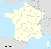
Aspremont (Hautes-Alpes)

Aspremont (Hautes-Alpes)
Aspremont
Aspremont (Frankreich)
Aspremont
Region Provence-Alpes-Côte d’Azur
Département Hautes-Alpes
Arrondissement Gap
Kanton Aspres-sur-Buëch
Koordinaten 44° 30′ N, 5° 44′ O44.4933333333335.7283333333333715Koordinaten: 44° 30′ N, 5° 44′ O
Höhe 715 m (696–1.378 m)
Fläche 18,52 km²
Einwohner 306 (1. Jan. 2008)
Bevölkerungsdichte 17 Einw./km²
Postleitzahl 05140
INSEE-Code
Website http://www.aspremont05.fr/

Aspremont ist eine französische Gemeinde mit 306 Einwohnern (Stand 1. Januar 2008) im Département Hautes-Alpes in der Region Provence-Alpes-Côte d’Azur.

Inhaltsverzeichnis

Geografie

Die Gemeinde liegt am Nordrand des Départements Hautes-Alpes in rund fünf Kilometern Entfernung zum Département Drôme. Aspremont liegt 40 Kilometer von Gap entfernt.

Bevölkerungsentwicklung

Jahr 1962 1968 1975 1982 1990 1999 2007
Einwohner 171 191 182 196 216 238 303

Kultur und Sehenswürdigkeiten

  • Schlossruine
  • Kirche Saint-Pierre-aux-Liens aus dem 17. Jahrhundert

Wirtschaft und Infrastruktur

Durch Aspremont führt die D1075, die nach Norden hin auf die A51 nach Grenoble führt. In Richtung Süden führt die Straße ebenfalls auf die A51, in Richtung Aix-en-Provence.


Wikimedia Foundation.

Игры ⚽ Поможем сделать НИР

Schlagen Sie auch in anderen Wörterbüchern nach:

  • Aspremont (Hautes-Alpes) — Pour les articles homonymes, voir Aspremont. 44° 29′ 36″ N 5° 43′ 42″ E …   Wikipédia en Français

  • Aspremont, Hautes-Alpes — Infobox Commune de France nomcommune=Aspremont région=Provence Alpes Côte d Azur département=Hautes Alpes arrondissement=Gap canton=Aspres sur Buëch insee=05008 cp=05140 maire=Alban Palpant mandat=2001 2008 intercomm=Haut Buëch… …   Wikipedia

  • Embrun (Hautes-Alpes) — Pour les articles homonymes, voir Embrun. 44° 33′ 57″ N 6° 29′ 46″ E …   Wikipédia en Français

  • Ancelle (Hautes-Alpes) — Pour les articles homonymes, voir Ancelle. 44° 37′ 27″ N 6° 12′ 26″ E …   Wikipédia en Français

  • Montmaur (Hautes-Alpes) — Pour les articles homonymes, voir Montmaur. 44° 34′ 19″ N 5° 52′ 29″ E …   Wikipédia en Français

  • Cervières (Hautes-Alpes) — Pour les articles homonymes, voir Cervières. 44° 52′ 14″ N 6° 43′ 21″ E …   Wikipédia en Français

  • Vars (Hautes-Alpes) — Pour les articles homonymes, voir Vars. 44° 35′ 45″ N 6° 41′ 26″ E …   Wikipédia en Français

  • Châteauvieux (Hautes-Alpes) — Pour les articles homonymes, voir Châteauvieux. 44° 29′ 05″ N 6° 03′ 06″ E …   Wikipédia en Français

  • Esparron (Hautes-Alpes) — Pour les articles homonymes, voir Esparron. 44° 27′ 16″ N 5° 54′ 13″ E …   Wikipédia en Français

  • Rochebrune (Hautes-Alpes) — Pour les articles homonymes, voir Rochebrune. 44° 27′ 25″ N 6° 10′ 39″ E …   Wikipédia en Français

Share the article and excerpts

Direct link
Do a right-click on the link above
and select “Copy Link”