- Babina Greda
-
Babina Greda  45.11666666666718.533333333333Koordinaten: 45° 7′ 0″ N, 18° 32′ 0″ O
Basisdaten Staat:  Kroatien
Gespanschaft:  Vukovar-Srijem
Einwohner: 4.262 (2001) Telefonvorwahl: (+385) 032 Postleitzahl: 32 276 Struktur und Verwaltung
(Stand: 2009, vgl.)Bürgermeister: Josip Krnić [1] Postanschrift: Vladimira Nazora 3
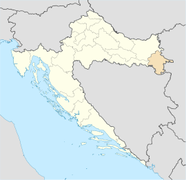
32276 Babina GredaWebpräsenz: Babina Greda ist ein Ort und eine Gemeinde in der Gespanschaft Vukovar-Syrmien, Region Slawonien in Ostkroatien.
Der Ort liegt etwa 40 km südwestlich von Vukovar an der Europastraße 70. Der Fluss Save, der hier auch die Grenze Kroatiens zu Bosnien und Herzegowina bildet, befindet sich nur etwa 2 km südlich von Babina Greda.
Im Jahr 2001 wohnten 4'262 Einwohner in Babina Greda, von welchen 98,78 Prozent Kroaten waren.[2]
Weblinks
Einzelnachweise
- ↑ Općine. Abgerufen am 1. Oktober 2009.
- ↑ 12. POPULATION BY ETHNICITY, BY TOWNS/MUNICIPALITIES, CENSUS 2001. Abgerufen am 1. Oktober 2009.
Städte und Gemeinden der Gespanschaft Vukovar-SrijemStädte: Ilok | Otok | Vinkovci | Vukovar | Županja
Gemeinden: Andrijaševci | Babina Greda | Bogdanovci | Borovo | Bošnjaci | Cerna | Drenovci | Gradište | Gunja | Ivankovo | Jarmina | Lovas | Markušica | Negoslavci | Nijemci | Nuštar | Privlaka | Stari Jankovci | Stari Mikanovci | Štitar | Tompojevci | Tordinci | Tovarnik | Trpinja | Vođinci | Vrbanja
Wikimedia Foundation.
Schlagen Sie auch in anderen Wörterbüchern nach:
Babina Greda — is a municipality in the Vukovar Srijem county in Croatia. According to the 2001 census, there are 4,262 inhabitants, 98.78% which are Croats. The name of the municipality translates closely as Grandma s Balk … Wikipedia
Babina Greda — Bȁbina Gréda ž DEFINICIJA naselje SZ od Županje, 4205 stan. ONOMASTIKA pr. (etnik): Bȁbinac, Babogrédac (Županja, Slavonija), v. bȁba … Hrvatski jezični portal
Babina Greda — Pour les articles homonymes, voir Babina. Babina Greda Pays Croatie Comitat … Wikipédia en Français
Babina Greda — Sp Bãbina Gredà Ap Babina Greda L Kroatija … Pasaulio vietovardžiai. Internetinė duomenų bazė
Babina — Cette page d’homonymie répertorie les différents sujets et articles partageant un même nom. Babina peut désigner : Toponymes en Croatie Babina Greda, un village et une municipalité située en … Wikipédia en Français
D520 road (Croatia) — D520 state road Route information Length: 7.6 km (4.7 mi) Major junctions … Wikipedia
Mijat Stojanović — (26 September 1818 – 18 September 1881) was a Croatian educator, ethnographer and folk writer. Mijat Stojanović was born in Babina Greda, a municipality in the Vukovar Srijem County in Croatia in 1818, and died in Zagreb in 1881. He was… … Wikipedia
A3 (Kroatien) — Vorlage:Infobox hochrangige Straße/Wartung/HR A Autocesta A3 in Kroatien … Deutsch Wikipedia
Vinkovci — City of Vinkovci Grad Vinkovci Vinkovci railway station … Wikipedia
Vukovar-Syrmia County — Croatian County name =Vukovarsko srijemska Županija image coat of arms size =100px Coat of arms image flag size =200px Flag capital =Vukovar area =2.448 km² population =204.768 date population =2001 density =83.6 /km² latd = latm = longd = longm … Wikipedia

