- Babusar-Pass
-
Babusar-Pass 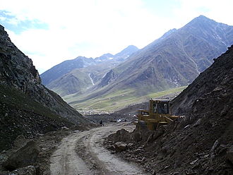
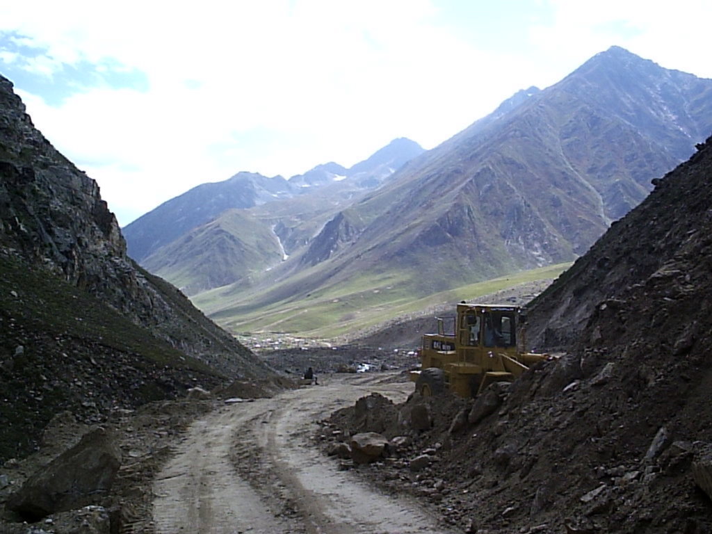
Piste kurz vor der Passhöhe
Norden Süden Passhöhe 4.173 m Provinz, Staat Gilgit-Baltistan, Pakistan Nordwestliche Grenzprovinz, Pakistan Wasserscheide Thak Kunhar Talorte Babusar Gittidas Ausbau unbefestigte Piste Gebirge Himalaya Karte 

Koordinaten 35° 9′ 0″ N, 74° 3′ 0″ O35.1574.054173Koordinaten: 35° 9′ 0″ N, 74° 3′ 0″ O Der Babusar-Pass oder Babusar Top mit einer Scheitelhöhe von 4173 m über Meereshöhe ist ein Hochgebirgspass im Norden von Pakistan. Er verbindet den Diamir-Distrikt in Gilgit-Baltistan im Norden mit dem Distrikt Kohistan in der Nordwestlichen Grenzprovinz. Der Pass befindet sich am Nordende des 150 km langen Kaghan-Tals. Von der Nordseite des Passes fließt der Fluss Thak Richtung Norden zum Tal des Indus. Vom Dorf Babusar führt eine Piste nach Chilas. Diese Straße erreicht 3 km von Chilas entfernt den Karakorum Highway. Der Pass ist von Mitte Juli bis zum September befahrbar und bei Monsun und im Winter nicht befahrbar. Das Kaghan-Tal ist von den Städten Balakot, Abbottabad und Mansehra aus erreichbar.[1]
Der Pass liegt in den nordwestlichsten Ausläufern des Himalaya. Der Bergrücken, auf dem der Pass liegt, erhebt sich im Osten in etwa 50 km Entfernung zum 8125 Meter hohen Nanga Parbat.
Weblink
Einzelnachweis
- ↑ Information auf lonleyplanet.com, abgerufen am 31. Dezember 2009
Kategorie:- Pass in Pakistan

Wikimedia Foundation.