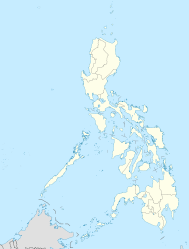
Cabilao

Cabilao

Vorlage:Infobox Insel/Wartung/Bild fehltVorlage:Infobox Insel/Wartung/Höhe fehlt

Cabilao
Gewässer Pazifischer Ozean
Inselgruppe Visayas
Geographische Lage 9° 52′ 43″ N, 123° 46′ 23″ O9.8786111111111123.77305555556Koordinaten: 9° 52′ 43″ N, 123° 46′ 23″ O
Cabilao (Philippinen)
Cabilao
Fläche 8 km²
Einwohner 3.500
438 Einw./km²
Hauptort Looc

Cabilao ist eine kleine Insel der Philippinen. Sie gehört zu den Visayas, der zentralen Inselgruppe der Philippinen.

Die dreieckige Insel mit einer Fläche knapp 8 km² und etwa 3500 Einwohnern liegt 7,5 Kilometer vor der Westküste der Insel Bohol, innerhalb der gleichnamigen Inselprovinz. Hauptort von Cabilao ist Looc in der Inselmitte.

Die Inselbewohner leben traditionell von Landwirtschaft und Fischfang, neuerdings auch vom Tourismus (vornehmlich dem Tauchtourismus).

Weblinks


Wikimedia Foundation.

Игры ⚽ Нужно решить контрольную?

Schlagen Sie auch in anderen Wörterbüchern nach:

  • Cabilao — Original name in latin Cabilao Name in other language Cabilao, Cabilao Pequeno, Cabilao Pequeo, Kabilao State code PH Continent/City Asia/Manila longitude 11.5396 latitude 123.1436 altitude 7 Population 2668 Date 2012 01 17 …   Cities with a population over 1000 database

  • Bohol — Infobox Philippine province name = Bohol sealfile = Ph seal bohol.png region = Central Visayas (Region VII) capital = Tagbilaran City founded = March 25, 1565 pop2000 = 1,137,268 pop2000rank = 18th largest popden2000 = 276 popden2000rank = 25th… …   Wikipedia

  • Legislative districts of Zamboanga Sibugay — Philippines This article is part of the series: Politics and government of the Philippines …   Wikipedia

  • Carles — Municipality of Carles Lage von Carles in der Provinz Iloilo Basisdaten Bezirk: Western …   Deutsch Wikipedia

  • Carles (Iloilo) — Pour les articles homonymes, voir Carles. Carte d Iloilo Carles est une municipalité de la province d Iloilo, aux Philippines. La municipalité …   Wikipédia en Français

  • List of islands of the Philippines — This is a list of islands of the Philippines. There are 7,107 islands, of which about 4,000 are inhabited. They are clustered into the island groups of Luzon, Visayas, and Mindanao.Luzon**Batanes Islands ***Batan Island ***Diadekey Island… …   Wikipedia

  • Makilala, Cotabato — Makilala   Municipality   Municipality of Makilala, Cotabato Map of Cotabato showing the locatio …   Wikipedia

  • 9th Congress of the Philippines — Philippines This article is part of the series: Politics and government of the Philippines …   Wikipedia

  • Legislative districts of Zamboanga del Sur — Philippines This article is part of the series: Politics and government of the Philippines …   Wikipedia

  • List of schools in Bohol — This is a list of schools in Bohol, Philippines. Alburquerque:# Alburquerque Central Elementary School # San Roque National High School, Alburquerque, Bohol Alicia: # Alicia National High School # Blessed Elena Kindergarten School # Blessed… …   Wikipedia

Share the article and excerpts

Direct link
Do a right-click on the link above
and select “Copy Link”