Cabrillo Bridge — Infobox Bridge bridge name = Cabrillo Bridge caption = The bridge as built in 1915, with pond and the Camino Cabrillo road underneath. official name = carries = El Prado crosses = Cabrillo Canyon locale = San Diego, California maint = id = design … Wikipedia
Juan Rodríguez Cabrillo — (ca. 1499 ndash; January 3, 1543) was a Portuguese explorer, known as João Rodrigues Cabrilho in Portuguese, noted for his exploration of the west coast of North America while sailing for Spain. Cabrillo was the first European explorer to… … Wikipedia
Pasadena Freeway — Infobox road state=CA type=SR route=110 highway name=Pasadena Freeway alternate name=Arroyo Seco Parkway maint=Caltrans length mi=8.162 length ref= length round=3 history=Opened in 1940; renamed in 1954 direction a=South terminus… … Wikipedia
San Diego–Tijuana — This article is about the international metropolitan region. For the cites of San Diego and Tijuana, see San Diego and Tijuana. Coordinates: 32°32′31.87″N 117°01′46.63″W / … Wikipedia
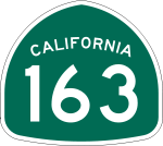
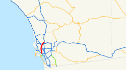
California State Route 163 — Infobox road state=CA type=SR route=163 section=463 maint=Caltrans alternate name=Cabrillo Freeway length mi=11 length round=0 length ref= [http://www.dot.ca.gov/hq/structur/strmaint/brlog2.htm January 1, 2006 California Log of Bridges on State… … Wikipedia
Interstate 8 — For other uses, see I8 (disambiguation). Interstate 8 Route information … Wikipedia
Interestatal 805 — Estados Unidos … Wikipedia Español
Southern California freeways — The freeways of Southern California, along with beaches, palm trees, and movie studios, are one of the major trademarks of this region. Perhaps no other urban areas in the world have embraced the automobile as passionately as have Greater Los… … Wikipedia
Californie Du Sud — Carte des dix comtés de la Californie du sud La Californie du sud (Southern California, SoCal ou Southland en anglais) est le nom donné à la mégalopole et région environnante qui occupe la partie sud de l État de Californie. Cependant, ces… … Wikipédia en Français
Californie du Sud — 34° N 117° W / 34, 117 … Wikipédia en Français
 I-15 in San Diego
