- Balugães
-
Balugães Wappen Karte 
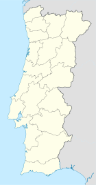

Basisdaten Region: Norte Unterregion: Cávado Distrikt: Braga Concelho: Barcelos Koordinaten: 41° 38′ N, 8° 39′ W41.640667-8.641759Koordinaten: 41° 38′ N, 8° 39′ W Einwohner: 863 (Stand: 2001) Fläche: 2,8 km² Bevölkerungsdichte: 308 Einwohner pro km² Balugães ist eine Gemeinde (Freguesia) im nordportugiesischen Kreis Barcelos. In ihr leben 863 Einwohner (Stand: 2001).[1]
Einzelnachweise
- ↑ Daten zu Balugães (en). alea.pt. Abgerufen am 2. Mai 2011.
Weblinks
- Karte der Freguesia Balugães beim Instituto Geográfico do Exército
 Freguesias im Concelho Barcelos
Abade de Neiva | Aborim | Adães | Aguiar | Airó | Aldreu | Alheira | Alvelos | Arcozelo | Areias | Areias de Vilar | Balugães | Barcelinhos | Barcelos | Barqueiros | Cambeses | Campo | Carapeços | Carreira | Carvalhal | Carvalhas | Chavão | Chorente | Cossourado | Courel | Couto de Esteves | Creixomil | Cristelo | Durrães | Encourados | Faria | Feitos | Fonte Coberta | Fornelos | Fragoso | Gamil | Gilmonde | Góios | Grimancelos | Gueral | Igreja Nova | Lama | Lijó | Macieira de Rates | Manhente | Mariz | Martim | Midões | Milhazes | Minhotães | Monte de Fralães | Moure | Negreiros | Oliveira | Palme | Panque | Paradela | Pedra Furada | Pereira | Perelhal | Pousa | Quintiães | Remelhe | Roriz | Santa Eugénia de Rio Covo | Santa Eulália de Rio Covo | Santa Leocádia de Tamel | Santa Maria de Galegos | Santo Estêvão de Bastuço | São João de Bastuço | São Martinho da Vila Frescainha | São Martinho de Alvito | São Martinho de Galegos | São Pedro de Alvito | São Pedro de Fins de Tamel | São Pedro de Vila Frescainha | São Veríssimo de Tamel | Sequeade | Silva | Silveiros | Tregosa | Ucha | Várzea | Viatodos | Vila Boa | Vila Cova | Vila Seca | Vilar de Figos | Vilar do Monte
Wikimedia Foundation.
Schlagen Sie auch in anderen Wörterbüchern nach:
Balugães — Saltar a navegación, búsqueda 41°38′24″N 8°38′28″O / 41.64, 8.64111 … Wikipedia Español
Balugães — Infobox Parish pt official name = Balugães image coat of arms = BCL balugaes.png Municipality = Barcelos area total = 2.98 population total = 863 (2001) population density = 289.6 website = footnotes =Balugães is a Portuguese parish, located in… … Wikipedia
Районы округа Брага — … Википедия
Балугайнш — Район Балугайнш Balugães Герб … Википедия
Barcelos Municipality, Portugal — Barcelos Municipality Flag … Wikipedia
List of postal codes in Portugal — Aveiro districtMealhada municipality*3050 Antes *3050 Barcouço *3050 Casal Comba *3050 Luso *3050 Mealhada *3050 Pampilhosa *3050 Vacariça *3050 Ventosa do BairroMurtosa municipality*3870 Bunheiro *3870 Monte *3870 Murtosa *3870 TorreiraOliveira… … Wikipedia
Chavão — Parish Country Portugal Municipality Barcelos Area – Total 2.00 km2 (0.8 sq mi) … Wikipedia
Chorente — Parish Coat of arms … Wikipedia
Cossourado — Parish Country Portugal Municipality Barcelos Area – Total 6.41 km2 (2.5 sq mi) … Wikipedia
Courel — Parish Coat of arms … Wikipedia
Balugães


18+
© Academic, 2000-2025
- Kontaktieren Sie uns: Unterstützung, Werbung
Wörterbücher Export, schritte mit PHP, Joomla, Drupal, WordPress, MODx.