- Manhente
-
Manhente Wappen Karte 
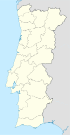
Basisdaten Region: Norte Unterregion: Cávado Distrikt: Braga Concelho: Barcelos Koordinaten: 41° 33′ N, 8° 34′ W41.548271-8.571211Koordinaten: 41° 33′ N, 8° 34′ W Einwohner: 1.587 (Stand: 2001) Fläche: 3,9 km² Bevölkerungsdichte: 407 Einwohner pro km² Politik Webseite: www.manhente.maisbarcelos.pt Manhente ist eine Gemeinde (Freguesia) im nordportugiesischen Kreis Barcelos. In ihr leben 1587 Einwohner (Stand: 2001).[1]
Einzelnachweise
- ↑ Daten zu Manhente (en). alea.pt. Abgerufen am 4. Mai 2011.
Weblinks
- Karte der Freguesia Manhente beim Instituto Geográfico do Exército
Abade de Neiva | Aborim | Adães | Aguiar | Airó | Aldreu | Alheira | Alvelos | Arcozelo | Areias | Areias de Vilar | Balugães | Barcelinhos | Barcelos | Barqueiros | Cambeses | Campo | Carapeços | Carreira | Carvalhal | Carvalhas | Chavão | Chorente | Cossourado | Courel | Couto de Esteves | Creixomil | Cristelo | Durrães | Encourados | Faria | Feitos | Fonte Coberta | Fornelos | Fragoso | Gamil | Gilmonde | Góios | Grimancelos | Gueral | Igreja Nova | Lama | Lijó | Macieira de Rates | Manhente | Mariz | Martim | Midões | Milhazes | Minhotães | Monte de Fralães | Moure | Negreiros | Oliveira | Palme | Panque | Paradela | Pedra Furada | Pereira | Perelhal | Pousa | Quintiães | Remelhe | Roriz | Santa Eugénia de Rio Covo | Santa Eulália de Rio Covo | Santa Leocádia de Tamel | Santa Maria de Galegos | Santo Estêvão de Bastuço | São João de Bastuço | São Martinho da Vila Frescainha | São Martinho de Alvito | São Martinho de Galegos | São Pedro de Alvito | São Pedro de Fins de Tamel | São Pedro de Vila Frescainha | São Veríssimo de Tamel | Sequeade | Silva | Silveiros | Tregosa | Ucha | Várzea | Viatodos | Vila Boa | Vila Cova | Vila Seca | Vilar de Figos | Vilar do Monte
Wikimedia Foundation.


