Banknock

Banknock
Banknock
Koordinaten 55° 59′ N, 3° 57′ W55.988611111111-3.9530555555556Koordinaten: 55° 59′ N, 3° 57′ W
Banknock (Schottland)
Banknock
Banknock
Bevölkerung 2.529 (Zensus 2001)
Verwaltung
Post town BONNYBRIDGE
Postleitzahlen­abschnitt FK4
Vorwahl 01324
Landesteil Scotland
Unitary authority Falkirk
Britisches Parlament Falkirk
Schottisches Parlament Falkirk West
Brücke in Banknock

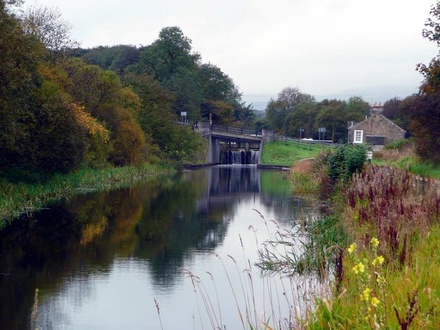
Banknock (von Gälisch Baile nan Cnoc[1]) ist eine Ortschaft in der schottischen Unitary Authority Falkirk und der traditionellen Grafschaft Stirlingshire. Sie ist 12 km westlich von Falkirk und 25 km nordöstlich von Glasgow nahe der Grenze von Falkirk und North Lanarkshire am Bonny Water gelegen. Im Jahre 2001 verzeichnete Banknock 2529 Einwohner.[2]

Mit Bankier befand sich zwischen 1827 und 1928 eine aktive Whiskybrennerei in Banknock.[3]

Verkehr

Die A80, die Glasgow mit Stirling verbindet, tangiert Banknock im Osten. Banknock wurde 1884 mit einem eigenen Bahnhof an das Schienennetz angeschlossen. Mit Aufgabe der Strecke im Jahre 1935 wurde auch der Bahnhof geschlossen. Als Schifffahrtsweg steht der südlich verlaufende Forth-and-Clyde-Kanal zur Verfügung.[4]

Einzelnachweise

  1. Verzeichnis gälischer Ausdrücke
  2. Statistische Daten
  3. Eintrag: Banknock, Bankier Distillery auf scotlandsplaces.gov.uk
  4. Eintrag im Gazetteer for Scotland

Wikimedia Foundation.

Игры ⚽ Нужен реферат?

Schlagen Sie auch in anderen Wörterbüchern nach:

  • Banknock — (Gaelic: Baile nan Cnoc ) is a village in the Falkirk unitary authority area in Scotland. Located on the Bonny Water, north of the Forth and Clyde canal and to the west of the A80 road which separates the village from Haggs, Banknock is a small… …   Wikipedia

  • Falkirk (Unitary Authority) — Falkirk an Eaglais Bhreac Verwaltungssitz Falkirk Fläche 297 km² (22.) …   Deutsch Wikipedia

  • GB-FAL — Falkirk an Eaglais Bhreac Verwaltungssitz Falkirk Fläche 297 km² (22.) …   Deutsch Wikipedia

  • Falkirk (council area) — infobox Scotland council area Council= Falkirk an Eaglais Bhreac SizeRank= 22nd Size= 297 km² Water= ? AdminHQ= Falkirk ISO= GB FAL ONS= 00QQ PopulationRank= 12th PopulationDate= 2004 Population= 147,460 PopulationDensity=496 / km² CouncilDetails …   Wikipedia

  • Denny, Falkirk — Coordinates: 56°01′05″N 3°54′25″W / 56.018°N 3.907°W / 56.018; 3.907 …   Wikipedia

  • Karine Polwart — Infobox musical artist Name = Karine Polwart Img size = Landscape = Background = Birth name = Alias = Born = 1971 Died = Origin = Banknock, Stirlingshire, UK Instrument = Genre = Folk music Occupation = Singer Years active = 2000 Label = Hegri… …   Wikipedia

  • Haggs — is a village in the Falkirk unitary authority area. On the east side of the A80 road which separates it from Banknock, Haggs is the location where the route of the A80 turns into motorway.Haggs is the location of the Haggs Parish Church which is… …   Wikipedia

  • List of state schools in Scotland/Council Areas E-H (excluding cities) — The following is a partial list of currently operating state schools in the unitary council areas of East Ayrshire, East Dunbartonshire, East Lothian, East Renfrewshire, Falkirk, Fife and Highland in Scotland, United Kingdom. You may also find of …   Wikipedia

  • Cumbernauld — Coordinates: 55°56′N 3°59′W / 55.94°N 3.98°W / 55.94; 3.98 …   Wikipedia

  • Polmont — Coordinates: 55°59′27″N 3°42′23″W / 55.990785°N 3.706423°W / 55.990785; 3.706423 …   Wikipedia

Share the article and excerpts

Direct link
Do a right-click on the link above
and select “Copy Link”