Bertiandos

Bertiandos
Bertiandos
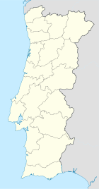
Wappen Karte
Das Wappen fehlt noch
Bertiandos (Portugal)
Bertiandos
Basisdaten
Region: Norte
Unterregion: Minho-Lima
Distrikt: Viana do Castelo
Concelho: Ponte de Lima
Koordinaten: 41° 46′ N, 8° 37′ W41.764063-8.624374Koordinaten: 41° 46′ N, 8° 37′ W
Einwohner: 392 (Stand: 2001)
Fläche: 2,3 km²
Bevölkerungsdichte: 170 Einwohner pro km²

Vorlage:Infobox Ort in Portugal/Wartung/Art ist leer

Vorlage:Infobox Ort in Portugal/Wartung/Karte ist leer


Vorlage:Infobox Ort in Portugal/Wartung/Höhe ist leer Vorlage:Infobox Ort in Portugal/Wartung/PLZ ist leer Vorlage:Infobox Ort in Portugal/Wartung/Bürgermeister ist leer

Vorlage:Infobox Ort in Portugal/Wartung/Einwohnerstand ist leer

Vorlage:Infobox Ort in Portugal/Wartung/Verwaltungsort ist leer Vorlage:Infobox Ort in Portugal/Wartung/Webseite ist leer Vorlage:Infobox Ort in Portugal/Wartung/Email ist leer

Bertiandos ist eine Gemeinde (Freguesia) im nordportugiesischen Kreis Ponte de Lima der Unterregion Minho-Lima. In ihr leben 392 Einwohner (Stand: 2001).[1]

Einzelnachweise

  1. Daten zu Bertiandos (en). alea.pt. Abgerufen am 15. Mai 2011.

Weblinks


Wikimedia Foundation.

Игры ⚽ Нужна курсовая?

Schlagen Sie auch in anderen Wörterbüchern nach:

  • Bertiandos and São Pedro de Arcos Lagoons Protected Landscape — is a protected landscape in Portugal. It is one of the 30 areas which are officially under protection in the country …   Wikipedia

  • Бертьяндуш — Район Бертьяндуш Bertiandos Страна ПортугалияПортугалия …   Википедия

  • Ponte de Lima — Saltar a navegación, búsqueda Ponte de Lima Escudo Bandera …   Wikipedia Español

  • Районы округа Виана-ду-Каштелу —   Это служеб …   Википедия

  • Protected areas of Portugal — The protected areas of Portugal include one national park, 13 natural parks, nine natural reserves, seven protected landscapes, five natural monuments, seven classified places and two specially designated areas. Two extensive areas of Portugal… …   Wikipedia

  • Районы округа Вьяна-ду-Каштелу — …   Википедия

  • Peneda-Gerês National Park — Coordinates: 41°43′49.22″N 8°9′42.05″W / 41.7303389°N 8.1616806°W / 41.7303389; 8.1616806 …   Wikipedia

  • Ponte de Lima — Infobox Municipality pt official name = Ponte de Lima image coat of arms = PTL.png Region = Norte Subregion = Minho Lima District = Viana do Castelo Mayor name = Daniel Campelo Mayor party = CDS area total = 320.3 population total = 44,667 (2006) …   Wikipedia

  • List of postal codes in Portugal — Aveiro districtMealhada municipality*3050 Antes *3050 Barcouço *3050 Casal Comba *3050 Luso *3050 Mealhada *3050 Pampilhosa *3050 Vacariça *3050 Ventosa do BairroMurtosa municipality*3870 Bunheiro *3870 Monte *3870 Murtosa *3870 TorreiraOliveira… …   Wikipedia

  • Serra da Estrela Natural Park — View of the park, from near the highest point to east Serra da Estrela Natural Park is situated in the largest mountain range in Portugal the Serra da Estrela, and is the source of the rivers Mondego, Zêzere (tributary of the Tagus), and Alva.… …   Wikipedia

Share the article and excerpts

Direct link
Do a right-click on the link above
and select “Copy Link”