- Borroloola
-
Borroloola 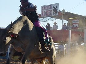
Rodeo in BorroloolaStaat:  Australien
Bundesstaat:  Queensland
Koordinaten: 16° 4′ S, 136° 18′ O-16.0704136.3072222222217Koordinaten: 16° 4′ S, 136° 18′ O Höhe: 17 m Einwohner: 773 (2006) [1] Zeitzone: AEST (UTC+10) Postleitzahl: 0854 

Borroloola Borroloola ist eine kleine Ortschaft im Northern Territory von Australien. Der Ort liegt am McArthur River innerhalb des Narwinbi Aboriginal Land Trust, rund 50 Kilometer südlich von der Mündung des Flusses in den Golf von Carpentaria und etwa 1000 Kilometer südöstlich von Darwin. Borroloola ist das Verwaltungszentrum der Gulf Region Australiens. Von den 773 Einwohnern sind rund 579 Aborigines.[1]
In der Umgebung von Borroloola werden Zink, Blei und Silber abgebaut. Borroloola ist für seine guten Angelmöglichkeiten insbesondere für Barramundi bekannt.
Borroloola wurde 1885 das erste Mal erwähnt. Zu dieser Zeit galt der Ort als Außenposten der Zivilisation und Hochburg für illegale Aktivitäten wie den Schmuggel.
Weblinks
- Information auf Australianexplorer.com
- Information auf Auinfo.com
- information auf Visitkatherine.com.au
Einzelnachweise
- ↑ a b Australian Bureau of Statistics (25. Oktober 2007): Borroloola (L) (Urban Centre/Locality) (Englisch). 2006 Census QuickStats. Abgerufen am 13. November 2008.


Wikimedia Foundation.