California State Route 182
Schlagen Sie auch in anderen Wörterbüchern nach:
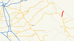
California State Route 182 — Infobox road state=CA type=SR route=182 section=482 maint=Caltrans length mi=12.65 length round=2 length ref= [ [http://www.dot.ca.gov/hq/structur/strmaint/brlog2.htm January 1, 2006 California Log of Bridges on State Highways] ] direction… … Wikipedia
California State Route 1 — For other uses, see CA1 (disambiguation). State Route 1 Route information … Wikipedia
California State Route 180 — Infobox road state=CA type=SR route=180 alternate name=Sequoia Kings Canyon Freeway, Kings Canyon Road section=480 maint=Caltrans length mi=112.31 length ref= [http://www.dot.ca.gov/hq/structur/strmaint/brlog2.htm January 1, 2006 California Log… … Wikipedia
California State Route 183 — Infobox road state=CA type=SR route=183 section=483 maint=Caltrans length mi=10 length round=0 length ref= [ [http://www.dot.ca.gov/hq/structur/strmaint/brlog2.htm January 1, 2006 California Log of Bridges on State Highways] ] direction a=South… … Wikipedia
Nevada State Route 338 — State Route 338 Sweetwater Road Route information Maintained by NDOT Length … Wikipedia
Nevada State Route 264 — State Route 264 Fish Lake Valley Road, Dicalite Cutoff Route information Maintained by NDOT Length … Wikipedia
Nevada State Route 22 — State Route 22 is the previous designation for State Route 338 and State Route 829 from Wellington south to the California state line at SR 182 … Wikipedia
California Freeway and Expressway System — The California Freeway and Expressway System is a system of existing or planned freeways and expressways in the U.S. state of California. It is defined by the Streets and Highways Code.List of roads in the system*State Route 1 (part) *State Route … Wikipedia
List of highways numbered 182 — The following highways are numbered 182: United States Interstate 182 Alabama State Route 182 California State Route 182 … Wikipedia
Liste der State-, U.S.- und Interstate-Highways in Kalifornien — Dies ist eine Aufstellung von State Highways in Kalifornien, USA nach Nummern. Inhaltsverzeichnis 1 State Routes 2 Interstates 2.1 Zubringer und Umgehungen 3 U.S. Highways … Deutsch Wikipedia
 US 395 in Bridgeport
 NV 338


