Bulok

Bulok
Bulok
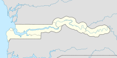
13.176718057778-16.414660441111{{{elevation_save}}}Koordinaten: 13° 11′ N, 16° 25′ W
Karte: Gambia
marker
Region: West Coast
Distrikt: Foni Brefet
Einwohner: 2.355 (2010)

EW3

Bulok (Schreibvariante: Bulock) ist eine Ortschaft im westafrikanischen Staat Gambia.

Nach einer Berechnung für das Jahr 2010 leben dort etwa 2355 Einwohner, das Ergebnis der letzten veröffentlichten Volkszählung von 1993 betrug 1450.[1]

Geographie

Bulok liegt in der West Coast Region, Distrikt Foni Brefet, rund 30 Kilometer östlich von Brikama und 39 Kilometer westlich von Bwiam entfernt. Der Ort liegt an der South Bank Road, die Bulok Bridge liegt westlich des Orts.

Siehe auch

Einzelnachweise

  1. Bulok in World Gazetteer, Zugriff Juni 2010

Wikimedia Foundation.

Игры ⚽ Поможем сделать НИР

Schlagen Sie auch in anderen Wörterbüchern nach:

  • Bulok — Infobox Settlement official name =PAGENAME native name = imagesize = image caption = image map caption = pushpin pushpin label position =bottom pushpin mapsize = 300 pushpin map caption =Location in Tajikistan subdivision type = Country… …   Wikipedia

  • Bulok Bridge — 13.178466109167 16.4204885125 Koordinaten: 13° 10′ 42,5″ N, 16° 25′ 13,8″ W BWf1 …   Deutsch Wikipedia

  • South Bank Road — In der Nähe von Somita Zwischen Soma und Janjanbureh …   Deutsch Wikipedia

  • Toledo City — Toledo City, formerly known as Pueblo Hinulawan, is a 2nd class city in the province of Cebu, Philippines. According to the 2007 census, it has a population of 152,960 people.On June 19, 1960, Toledo attained the status of a chartered city by… …   Wikipedia

  • Toledo, Cebu — Toledo City Dakbayan sa Toledo   City   Map of Cebu showing the location of Toledo City …   Wikipedia

  • List of caves — The following is a partial list of caves. Africa Algeria * Ain Bird Zaa El Kbira * Anou Achra Lemoun * Anou Boussouil * Anou Ifflis * Anou Timedouine * Aven Yebdar * Grotte Des Ain Beni Add * Kef Al Kaous * Rhar El Kahal * Rivière De La Tafna *… …   Wikipedia

  • Malabuyoc, Cebu — Malabuyoc   Municipality   Country …   Wikipedia

  • Koronadal City — Infobox Philippine city infoboxtitle = City of Koronadal sealfile = koronadal logo.jpg locatormapfile = Ph locator south cotabato koronadal.png caption = Map of South Cotabato showing the location of Koronadal City. region = SOCCSKSARGEN (Region… …   Wikipedia

  • Yoyoy Villame — Infobox Musical artist Name = Yoyoy Villame Img capt = Background = solo singer Birth name = Roman Tesorio Villame Born = birth date|1932|11|18 Died = death date and age|2007|5|18|1932|11|18|mf=y Origin = Calape, Bohol, Philippines Instrument =… …   Wikipedia

  • Sansankoto Island — Vorlage:Infobox Insel/Wartung/Fläche fehltVorlage:Infobox Insel/Wartung/Höhe fehlt Sansankoto Island …   Deutsch Wikipedia

Share the article and excerpts

Direct link
Do a right-click on the link above
and select “Copy Link”