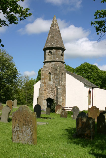
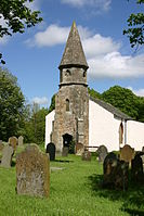
Camerton, Cumbria — infobox UK place static static image caption= Camerton Hall country = England official name= Camerton latitude= 54.65 longitude= 3.48 population = 172 (2001) shire district= Allerdale shire county = Cumbria region= North West England constituency … Wikipedia
Camerton — may mean several things:PlacesThere are three villages in England called Camerton: * Camerton, Cumbria * Camerton, Somerset * Camerton, East Riding of YorkshireOther* Camerton (boy band), a pop band from Mongolia … Wikipedia
Camerton, Somerset — infobox UK place country = England official name= Camerton population = os grid reference = ST685578 latitude= 51.3188 longitude= 2.4526 unitary england= Bath and North East Somerset lieutenancy england = Somerset region= South West England post… … Wikipedia
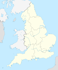
Civil parishes in Cumbria — A map of Cumbria, showing the districts: (1) Barrow in Furness; (2) South Lakeland; (3) Copeland; (4) Allerdale; (5) Eden; and (6) Carlisle. A civil parish is a subnational entity, forming the lowest unit of local government in England. There are … Wikipedia
Seaton, Cumbria — infobox UK place country = England official name= Seaton latitude= 54.6647 longitude= 3.5227 population = 5,100 (2001) shire district= Allerdale shire county = Cumbria region= North West England constituency westminster= Workington post town=… … Wikipedia
List of places in Cumbria — This is a list of cities, towns and villages in the county of Cumbria, England. See the list of places in England for places in other counties.compactTOC NOTOC A*Abbey Town, Above Derwent, Ackenthwaite, Adgarley, Aglionby *Aiketgate, Aikhead,… … Wikipedia
Coniston railway station, Cumbria — For the Australian station of the same name, see Coniston railway station, New South Wales. Coniston Location Place Coniston Area Cumbria Coordinates … Wikipedia
List of civil parishes in Cumbria — This is a list of civil parishes in Cumbria, England. Most parishes have their own parish council, but some smaller parishes may have a parish meeting, or may join together as a combined parish council. Some larger parishes have town status, and… … Wikipedia
River Derwent, Cumbria — Geobox|River name = Derwent native name = other name = other name1 = image size = image caption = country = United Kingdom country1 = state = state1 = region = region1 = district = district1 = city = city1 = length = watershed = discharge… … Wikipedia
Workington — For other uses, see Workington (disambiguation). Coordinates: 54°38′11″N 3°33′18″W / 54.6365°N 3.5549°W / 54.6365; 3.5549 … Wikipedia

 Commons: Camerton – Sammlung von Bildern, Videos und AudiodateienKategorie: