Cayemites

Cayemites
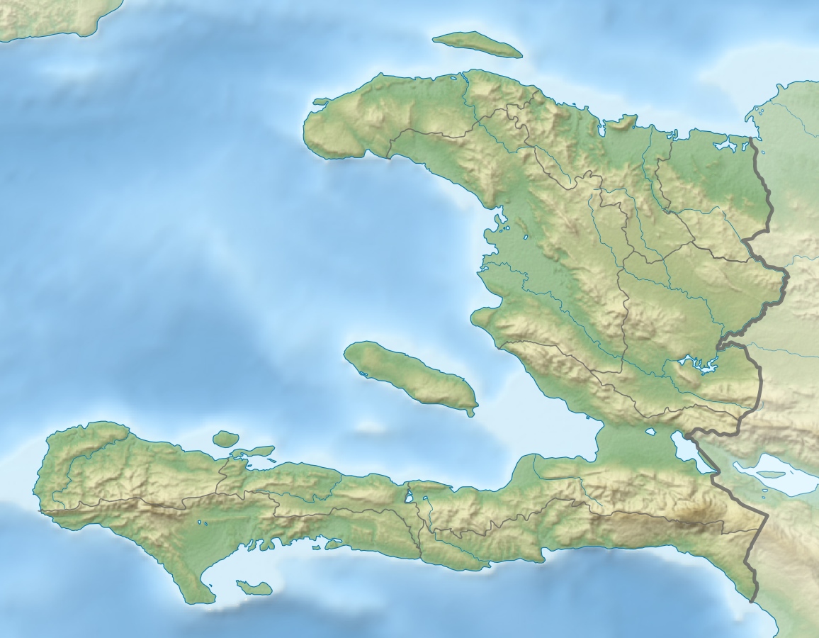
Cayemites
Gewässer Karibisches Meer
Archipel Große Antillen
Geographische Lage 18° 37′ N, 73° 45′ W18.613711831111-73.750019073611Koordinaten: 18° 37′ N, 73° 45′ W
Cayemites (Haiti)
Cayemites
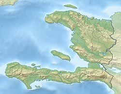
Anzahl der Inseln 2
Hauptinsel Grande Cayemite
Gesamtfläche 45 km²
Einwohner 18.000
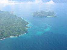
Cayemites (2007)

Die Cayemites (kreol. Kayimit, französisch Les Cayemites) sind zwei Inseln im Golf von Gonâve im Westen vor der Nordküste der Tiburon-Halbinsel Haitis: Grande Cayemite (Gwo Kayimit) und Petite Cayemite (Ti Kayimit).

Die Inseln sind zusammen 45 Quadratkilometer groß. Das nur etwa einen Quadratkilometer kleine Petite Cayemite liegt unmittelbar westlich von Grande Cayemite. Die Inseln befinden sich ungefähr 35 Kilometer östlich der Stadt Jérémie und gehören verwaltungsmäßig zum Departement Grand’Anse bzw. zur gegenüber an der Küste liegenden Gemeinde Pestel. Die Einwohnerzahl beträgt 18.000. Die Inselhauptstadt ist Anse à Macon (2500 Einwohner)[1] an der Südostküste, der nächstgrößere Ort Pointe Sable (1600 Ew.). Wassermangel schränkt die Landwirtschaft ein. Es wird Fischfang betrieben.

Einzelnachweise

  1. http://www.haitiwebs.com/emagazine/content/view/121/155/lang,en/

Weblinks


Wikimedia Foundation.

Игры ⚽ Нужно решить контрольную?

Schlagen Sie auch in anderen Wörterbüchern nach:

  • Cayemites — Cayemites, 2 Eilande an der Nordküste der großen Antilleninsel Hayti; die größere hat etwa 4 Stunden im Umfang; die andere ist viel unbedeutender u. liegt südwestlich davon …   Pierer's Universal-Lexikon

  • Cayemites — Mapa de Haití mostrando el departamento de Grand Anse al que pertenecen Las Cayemites. Cayemites (2007) Las Cayemi …   Wikipedia Español

  • Cayemites — The Cayemites are a pair of islands located in the Gulf of Gonâve off the coast of southwest Haiti. The two islands, known individually as Grande Cayemite and Petite Cayemite, are a combined convert|45|km2|sqmi| in area. [cite book | last =… …   Wikipedia

  • Les Cayemites — 18°37′0″N 73°45′0″O / 18.61667, 73.75 …   Wikipédia en Français

  • Golfo de la Gonâve — (Golfe de la Gonâve) Vista de satélite del golfo (en el centro de la imagen se aprecia la isla de la Gonâve) …   Wikipedia Español

  • Haiti — Republic of Haiti République d Haïti (French) Repiblik Ayiti …   Wikipedia

  • Geography of Haiti — Continent Americas Region Caribbean Greater Antilles Coordinates 19°00 N 72°25 W Area …   Wikipedia

  • List of islands in the Caribbean — This is a list of islands of the Caribbean region, organized by the political territory each island belongs to.Anguilla* Anguilla * Anguillita * Blowing Rock * Cove Cay * Crocus Cay * Deadman s Cay * Dog Island * East Cay * Little Island * Little …   Wikipedia

  • Gulf of Gonâve — ( fr. Golfe de la Gonâve) is a large gulf along the western coast of Haiti, at coord|19|N|73.5|W|. [citeweb|title=Île de la Gonâve|url=http://encarta.msn.com/encyclopedia 762528593/gon%C3%A2ve %C3%8Ele de la.html|publisher= Encarta… …   Wikipedia

  • Geographie d'Haiti — Géographie d Haïti Géographie d Haïti Continent Amérique Région Caraïbes Coordonnées 19°00 N, 72°25 W Superfi …   Wikipédia en Français

Share the article and excerpts

Direct link
Do a right-click on the link above
and select “Copy Link”