- Charbinowice
-
Charbinowice 
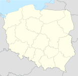
Basisdaten Staat: Polen Woiwodschaft: Heiligkreuz Landkreis: Kazimierski Gmina: Opatowiec Geographische Lage: 50° 17′ N, 20° 37′ O50.28027777777820.608611111111Koordinaten: 50° 16′ 49″ N, 20° 36′ 31″ O Höhe: 231 m n.p.m Einwohner: Postleitzahl: 28-520 Telefonvorwahl: (+48) 41 Kfz-Kennzeichen: TKA Charbinowice ist ein Dorf in der Gemeinde Opatowiec im Powiat Kazimierski. Es liegt auf einer Höhe von etwa 231 Metern über dem Meeresspiegel in der Woiwodschaft Heiligkreuz in Polen. Das Verwaltungszentrum der Gemeinde in Opatowiec ist etwa zehn Kilometer in südöstlicher Richtung von Charbinowice entfernt. Haupteinnahmequelle des Dorfes ist die Forst- und Landwirtschaft.
Quelle
Kategorie:- Ort der Woiwodschaft Heiligkreuz
Wikimedia Foundation.

