Chuska Lake

Chuska Lake
Chuska Lake

Photo-request.svg

Bild gesucht 

BW

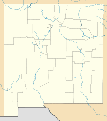
Geographische Lage Navajo Nation Reservation, McKinley County, New Mexico, USA
Abfluss zum Red Willow Wash
Daten
Koordinaten 35° 50′ 41″ N, 108° 44′ 10″ W35.8447376-108.73619651921Koordinaten: 35° 50′ 41″ N, 108° 44′ 10″ W
Chuska Lake (New Mexico)
Chuska Lake
Höhe über Meeresspiegel 1.921 m
Fläche 33,56 haf5

Chuska Lake ist ein Stausee in der Navajo Nation Reservation, etwa 3 Kilometer südwestlich von Tohatchi, westlich abseits der U.S. Route 491 (auch als Devil’s Highway bekannt (ehemals U.S. Route 666), im McKinley County, im US-Bundesstaat New Mexico, in den Vereinigten Staaten. Er wird von einem Zufluss des Red Willow Wash gespeist, der dem Colorado-River-Flusssystem angehört.[1][2] Seine Fläche beträgt 33,56 Hektar und die Höhe über dem Meeresspiegel 1921 Meter.[1]

Ansässige Fischarten sind Welsartige, Barschartige sowie auch diverse Forellenarten, wie unter anderem die Cutthroatforelle (Oncorhynchus clarkii) und die Regenbogenforelle.[3]

Einzelnachweise

  1. a b San Juan Watershed Major Lakes and Streams (PDF-Datei (10,5 MB), Seite 18)
  2. Chuska Lake im Geographic Names Information System des United States Geological Survey
  3. USEPA-Pdf-Datei (Seite 5)

Wikimedia Foundation.

Игры ⚽ Нужна курсовая?

Schlagen Sie auch in anderen Wörterbüchern nach:

  • Liste der Seen der Vereinigten Staaten — Inhaltsverzeichnis 1 Seen nach Gewässerart 1.1 Süßwasserseen 1.2 Salz bzw. Brackwasserseen 1.3 Stauseen …   Deutsch Wikipedia

  • Colorado Plateau — A map of the Colorado Plateau. The …   Wikipedia

  • Chaco Culture National Historical Park — Chaco Culture National Historical Park …   Wikipedia

  • Beautiful Mountain — Infobox Mountain Name = Beautiful Mountain Photo = Caption = Elevation = convert|9388|ft|m|0|lk=on Location = New Mexico, USA Prominence = convert|1508|ft|m|0|lk=on Coordinates = coord|36|28|N|109|0|W|type:mountain region:US Topographic Type =… …   Wikipedia

  • Shiprock — Infobox Mountain Name = Shiprock Photo = Shiprock.snodgrass3.jpg Caption = Shiprock Elevation = convert|7177|ft|m|0|lk=on Location = New Mexico, USA Prominence = convert|1583|ft|m|0|abbr=on Coordinates = coord|36|41|16|N|108|50|12|W|type:mountain …   Wikipedia

  • Manuelito — Tribe Navajo Nomjanyola …   Wikipedia

  • Canyon de Chelly National Monument — IUCN Category III (Natural Monument) Canyon de Chelly, 1904, by Edward S. Curtis …   Wikipedia

  • Navajo people — Navajo Diné, Naabeehó Navajo portraits Total population 300,048 (2011)[1] …   Wikipedia

  • Uranium mining in New Mexico — Uranium mining in New Mexico, a state of the United States, was a significant industry from the early 1950s until the early 1980s. Although New Mexico has the second largest identified uranium ore reserves of any state in the US (after Wyoming),… …   Wikipedia

  • San Juan — /san wahn , hwahn /; Sp. /sahn hwahn / 1. a seaport in and the capital of Puerto Rico, in the N part. 424,600. 2. a city in W Argentina. 290,479. 3. a river in S Nicaragua, flowing E from Lake Nicaragua along the Nicaragua Costa Rica border to… …   Universalium

Share the article and excerpts

Direct link
Do a right-click on the link above
and select “Copy Link”