Country Villa Juana

Country Villa Juana
-34.776111111111-55.894166666667
Country Villa Juana
Country Villa Juana (Uruguay)
Country Villa Juana
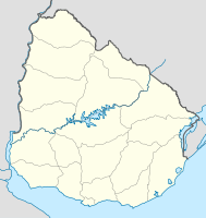
Country Villa Juana

Country Villa Juana auf der Karte von Uruguay

Basisdaten
Staat Uruguay
Departamento Canelones
Einwohner 19 (2004)
Detaildaten

Country Villa Juana ist eine Ortschaft in Uruguay.

Inhaltsverzeichnis

Geographie

Sie befindet sich im Süden des Departamento Canelones in dessen Sektor 17. Country Villa Juana, östlich des Arroyo Pando gelegen, ist dabei von der Küste des Río de la Plata lediglich durch die südlich vorgelagerten Küstenorte Neptunia und El Pinar getrennt.

Infrastruktur

Östlich von Country Villa Juana verläuft die Ruta 34 nach Norden.

Einwohner

Die Einwohnerzahl von Country Villa Juana beträgt 19 (Stand 2004).[1] Damit war der Ort im Jahr 2004 nach Einwohnern der zweitkleinste des Departamentos. Lediglich Carmel rangierte mit 13 Einwohnern noch hinter Country Villa Juana.

Jahr Einwohner
1996 -
2004 19

Quelle: Instituto Nacional de Estadística de Uruguay[2]

Weblinks

Einzelnachweise

  1. Statistische Daten des Instituto Nacional de Estadística de Uruguay – Stand 2004, abgerufen am 24. Oktober 2010
  2. Statistische Daten des Instituto Nacional de Estadística de Uruguay 1963–1996 (DOC)

Wikimedia Foundation.

Игры ⚽ Поможем написать реферат

Schlagen Sie auch in anderen Wörterbüchern nach:

  • Pancho Villa — José Doroteo Arango Arámbula Pancho Villa …   Wikipedia Español

  • Cumbia music by country — Due to the diversity of Latin America, Colombian and Panamanian cumbia music has undergone major changes as it mixed with the regional music styles of several countries (especially in Ecuador, Peru and Mexico). There are several distinct… …   Wikipedia

  • Costa de Oro — is a 45 km long group of resort towns and beaches in Canelones Department, Uruguay, east of the Ciudad de la Costa.[1][2] Until 19 October 1994 it also included all the resorts that became henceforth integrated under the name Ciudad de la… …   Wikipedia

  • El Pinar (Uruguay) — 34.7975 55.912222222222 Koordinaten: 34° 48′ S, 55° 55′ W El Pinar …   Deutsch Wikipedia

  • Distrito Nacional — Coordinates: 18°30′0″N 69°59′0″W / 18.5°N 69.983333°W / 18.5; 69.983333 …   Wikipedia

  • Santo Domingo — This article is about the city. For other uses, see Santo Domingo (disambiguation). Santo Domingo   City   Santo Domingo de Guzmán …   Wikipedia

  • Centro Olímpico Juan Pablo Duarte — Viejo Villa Duarte …   Wikipedia

  • Centro de Los Heroes — Centro de Los Heroes …   Wikipedia

  • Cerros de Arroyo Hondo — Cerros de Arroyo Hondo …   Wikipedia

  • Ciudad Nueva — Ciudad Nueva …   Wikipedia

Share the article and excerpts

Direct link
Do a right-click on the link above
and select “Copy Link”