- Cristoval
-
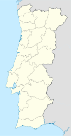
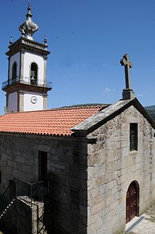
Cristoval Wappen Karte Basisdaten Region: Norte Unterregion: Minho-Lima Distrikt: Viana do Castelo Concelho: Melgaço Koordinaten: 42° 8′ N, 8° 12′ W42.12608-8.19916Koordinaten: 42° 8′ N, 8° 12′ W Einwohner: 619 (Stand: 2001) Fläche: 5,6 km² Bevölkerungsdichte: 111 Einwohner pro km² Cristoval ist eine Gemeinde (Freguesia) im nordportugiesischen Kreis Melgaço.
In ihr leben 619 Einwohner (Stand: 2001).[1]
Einzelnachweise
- ↑ Daten zu Cristoval (en). alea.pt. Abgerufen am 11. Mai 2011.
Weblinks
- Karte der Freguesia Cristoval beim Instituto Geográfico do Exército
Freguesias im Concelho MelgaçoAlvaredo | Castro Laboreiro | Chaviães | Cousso | Cristoval | Cubalhão | Fiães | Gave | Lamas de Mouro | Paços | Paderne | Parada do Monte | Penso | Prado | Remoães | Roussas | São Paio | Vila
Wikimedia Foundation.
Schlagen Sie auch in anderen Wörterbüchern nach:
Cristoval — Parish Coat of arms … Wikipedia
Cristōval, S. — S. Cristōval, 1) Stadt, so v.w. Seregype del Rev; 2) See, in Mexico, 11/3 QM. Flächenraum, mit dem Tezcucosee verbunden; 3) Insel, zum Salomonsarchipel (Polynesien) gehörig; 4) Vorgebirg der großen Antilleninsel Cuba (Spanisch Westindien); 5) so… … Pierer's Universal-Lexikon
Cristoval Royas de Spinola — (or Christopher, Rojas), born of a noble Spanish family, near Roermond in Gelderland in 1626; died at Wiener Neustadt, 12 March 1695, was a Spanish Franciscan diplomat and Bishop of Wiener Neustadt. Life Educated at Cologne, he entered the… … Wikipedia
San Cristoval — (Arossi, Bauro), eine der engl. Salomoninseln (s. d.), 125 km lang, 15–30 km breit und 3050 qkm groß, mit dem guten Hafen Makira, vulkanischer Formation, gebirgig, bis 1250 m hoch, reich bewaldet und fruchtbar, aber ungesund … Meyers Großes Konversations-Lexikon
Spanisch-Portugiesischer Befreiungskrieg von 1808-1814 — Spanisch Portugiesischer Befreiungskrieg von 1808–1814 (Krieg auf der Pyrenäischen Halbinsel). I. Veranlassung des Kriegs. Auf dem Thron von Spanien, welches seit 1796 mit der Französischen Republik verbündet war, saß Karl IV., dessen Macht ganz… … Pierer's Universal-Lexikon
Extreme points of Portugal — This is a list of the extreme points of Portugal, the points that are farther north, south, east or west than any other location. Portugal * Northernmost Point mdash; village of Cevide, freguesia of Cristoval, municipality of Melgaço, distrito of … Wikipedia
List of Governors of Trinidad — This page lists Governors of Trinidad. See also list of Governors of Tobago, list of Governors of Trinidad and Tobago, list of Governors General of Trinidad and Tobago, list of Presidents of Trinidad and Tobago, list of Prime Ministers of… … Wikipedia
Warohunugamwanehaora — is a character in San Cristoval folklore in Melanesia; he is similar to Qat and Maui, being the youngest of a band of brothers.MythologyThe youngest of a family of brothers, Warohunugamwanehaora was born and grew to adulthood all in one day. His… … Wikipedia
Melgaco (Portugal) — Melgaço (Portugal) Pour les articles homonymes, voir Melgaço. Melgaço … Wikipédia en Français
Melgaço (Portugal) — Pour les articles homonymes, voir Melgaço. Melgaço … Wikipédia en Français