Cuchilla de Belén

Cuchilla de Belén

p1f1p3p5

Cuchilla de Belén
Lage Uruguay
Cuchilla de Belén (Uruguay)
Cuchilla de Belén
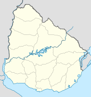
Koordinaten 30° 55′ S, 56° 30′ W-30.916666666667-56.5Koordinaten: 30° 55′ S, 56° 30′ W

Die Cuchilla de Belén ist eine Hügelkette in Uruguay.

Sie befindet sich im Norden des Landes auf dem Gebiet des Departamento Artigas. Dort verläuft sie in Ost-West-Richtung und dient als Wasserscheide der Einzugsgebiete des Río Cuareim im Norden und des Río Arapey Chico im Süden. In der Cuchilla de Belén entspringen neben dem Río Arapey Chico auch der Arroyo Ñaquiñá, der Arroyo Itacumbú, der Arroyo Mandiyú und der Arroyo Guaviyú.


Wikimedia Foundation.

Игры ⚽ Поможем сделать НИР

Schlagen Sie auch in anderen Wörterbüchern nach:

  • Cuchilla de Belén — Saltar a navegación, búsqueda La Cuchilla de Belén es una cadena de cerros que recorre el departamento de Artigas de Este a Oeste, dividiendo las lluvias y llevando sus aguas hacia el río Cuareim, en el Norte, y hacia el río Arapey Chico, en el… …   Wikipedia Español

  • Cuchilla de Belén — Sp Belèno kalvãgūbris Ap Cuchilla de Belén L Š Urugvajuje …   Pasaulio vietovardžiai. Internetinė duomenų bazė

  • Cuchilla — ist der Name von: Cuchilla Alta Creek, ein Fluss im US Bundesstaat Colorado Cuchilla Alta, eine Ortschaft in Uruguay Cuchilla de Belén, eine Hügelkette in Uruguay Cuchilla de Cerro Largo, eine Hügelkette in Uruguay Cuchilla de Dionisio, eine… …   Deutsch Wikipedia

  • Cuchilla Yacaré Cururú — p1f1p3p5 Cuchilla Yacaré Cururú Lage Uruguay …   Deutsch Wikipedia

  • Cuchilla de las Pavas (Artigas) — p1f1p3p5 Cuchilla de las Pavas Lage Uruguay …   Deutsch Wikipedia

  • Cuchilla de Haedo — Saltar a navegación, búsqueda La Cuchilla de Haedo es una cordillera de cuchillas que cruza el territorio Norte del Uruguay y separa las aguas que confluyen en el Río Negro de las que lo hacen en el Río Uruguay. La Cuchilla de Haedo comienza… …   Wikipedia Español

  • Arroyo Sarandí (Arroyo Yacuy, Salto) — Arroyo SarandíVorlage:Infobox Fluss/GKZ fehlt Lage Uruguay Flusssystem Río de la PlataVorlage:Infobox Fluss/FLUSSSYSTEM falsch Abfluss über Arr …   Deutsch Wikipedia

  • Cañada de Fidencio — Cañada de FidencioVorlage:Infobox Fluss/GKZ fehlt Lage Uruguay Flusssystem Río de la PlataVorlage:Infobox Fluss/FLUSSSYSTEM falsch Abfluss über …   Deutsch Wikipedia

  • Arroyo Yacuy — Arroyo YacuyVorlage:Infobox Fluss/GKZ fehlt Lage Uruguay Flusssystem Río de la PlataVorlage:Infobox Fluss/FLUSSSYSTEM falsch Abfluss über Río U …   Deutsch Wikipedia

  • Arroyo Guaviyú (Artigas) — Saltar a navegación, búsqueda Para el arroyo homónimo en el departamento de Paysandú, véase Arroyo Guaviyú (Paysandú). Arroyo Guaviyú Longitud n/d km Altitud de la fuente n/d msnm Caudal medio …   Wikipedia Español

Share the article and excerpts

Direct link
Do a right-click on the link above
and select “Copy Link”