Aberporth

Aberporth
Aberporth
Koordinaten 52° 8′ N, 4° 33′ W52.131302-4.542761Koordinaten: 52° 8′ N, 4° 33′ W
Aberporth (Wales)
Aberporth
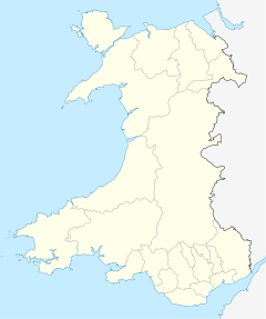
Aberporth
Verwaltung
Landesteil Wales
Unitary authority Ceredigion
Aberporth Versuchsgelände

Aberporth ist eine Stadt in Ceredigion an der walisischen Küste, genauer an der Cardigan Bay, bei 52°13' nördlicher Breite und 4°55' westlicher Länge.

Der Ort lebt vornehmlich vom Fremdenverkehr und ist ein vor allem bei Familien mit Kindern beliebter Strand- und Badeort, da der Strand des Badeortes in der Saison bewacht ist. Zu erreichen ist Aberporth über die M4 Abfahrt Carmarthen und dann über die M484 in Richtung Newcastle Emlyn.

In der Nähe von Aberporth befindet sich seit dem Zweiten Weltkrieg eine Erprobungsstelle für Raketen des britischen Militärs, von der auch zivile Höhenforschungsraketen für die Atmosphärenforschung gestartet wurden.

Weblinks

 Commons: Aberporth – Sammlung von Bildern, Videos und Audiodateien

Wikimedia Foundation.

Игры ⚽ Нужна курсовая?

Schlagen Sie auch in anderen Wörterbüchern nach:

  • Aberporth — is a village in Ceredigion on the west coast of Wales. Location It lies at the southern end of Cardigan Bay about six miles south of Cardigan and ten miles south of New Quay. Amenities The main industry was fishing and it still continues at a… …   Wikipedia

  • Aberporth — Original name in latin Aberporth Name in other language State code GB Continent/City Europe/London longitude 52.13248 latitude 4.54173 altitude 34 Population 1711 Date 2011 03 03 …   Cities with a population over 1000 database

  • Aberporth Airport — Infobox Airport name = Aberporth Airport nativename = nativename a = nativename r = West Wales/Aberporth Airport image width = caption = IATA = N/A ICAO = EGFA type = Public owner = operator = West Wales Aberporth, Airport Ltd. city served =… …   Wikipedia

  • Ceredigion — For other uses, see Ceredigion (disambiguation). Ceredigion Sir Ceredigion Geography Area Total  % …   Wikipedia

  • Tresaith — is a coastal village in the Welsh county of Ceredigion.Tresaith is between Aberporth and Llangranog; it is linked to the former by a two mile coastal path. Situated in West Wales, Tresaith is part of the Ceredigion Heritage Coastline which –… …   Wikipedia

  • New Quay — This article is about the town in Wales. For the similarly named town of Newquay in Cornwall, see Newquay. For other uses, see New Quay (disambiguation). New Quay Welsh: Cei Newydd …   Wikipedia

  • Devil's Bridge, Ceredigion — The three bridges, looking downstream …   Wikipedia

  • Mwnt — Coordinates: 52°08′13″N 4°38′20″W / 52.13684°N 4.63878°W / 52.13684; 4.63878 …   Wikipedia

  • Dinerth Castle — The Castle of Dinerth (Welsh: Castell Dineirth or Castell Dinerth, also Castell Allt Craig Arth) is a Welsh castle located near Aberarth, Ceredigion, west Wales (ca.1110). The ruins of the medieval timber castle can be found on a hill about 1½… …   Wikipedia

  • Penbryn — beach Penbryn (grid reference SN294520) is a village on the coast of Ceredigion in Wales, some ten miles up the coast from Cardigan between the vil …   Wikipedia

Share the article and excerpts

Direct link
Do a right-click on the link above
and select “Copy Link”