Cape Lookout

Cape Lookout
Cape Lookout (North Carolina)
Cape Lookout
Cape Lookout
Cape Lookout vor der Küste North Carolinas

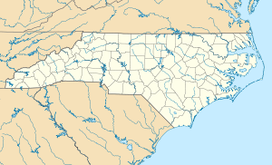
Cape Lookout (auch Kap Lookout) ist der südlichste Punkt der Outer Banks, einer vorgelagerten Inselkette vor der Ostküste des Bundesstaates North Carolina in den Vereinigten Staaten von Amerika. Die niedrige, sandige Inselkette, zu der das Kap gehört, liegt zwischen dem Atlantik und dem Atlantic Intracoastal Waterway, es bezeichnet das westliche Ende der Onslow Bay und des östliche Ende der Raleigh Bay.

Das Kap liegt an den Koordinaten 34° 36' 19" N und 76° 32' 10" W34.3619-76.321Koordinaten: 34° 21′ 43″ N, 76° 19′ 16″ W und ist Teil des Carteret County, etwa 18 Kilometer südöstlich der Kleinstadt Beaufort. Teile der Outer Banks, die an das Kap angrenzen, wurden zu einem nationalen Schutzgebiet, dem Cape Lookout National Seashore erklärt. Ebenfalls an diesem Kap steht der historische Leuchtturm Cape Lookout Lighthouse. Er ist der einzige Leuchtturm der Küste, der auch tagsüber betrieben wird, und ist mit Rauten anstatt des üblichen Streifenmusters bemalt.

Weblinks


Wikimedia Foundation.

Игры ⚽ Нужно сделать НИР?

Schlagen Sie auch in anderen Wörterbüchern nach:

  • Cape Lookout — can refer to:*Cape Lookout (North Carolina), in the United States *Cape Lookout (Oregon), in the United States *Cape Lookout (South Shetland Islands) …   Wikipedia

  • Cape Lookout — Sp Apžvalgõs kyšulỹs Ap Cape Lookout L JAV (Š. Karolina) …   Pasaulio vietovardžiai. Internetinė duomenų bazė

  • Cape Lookout State Park — Cape Lookout Der Cape Lookout State Park ist ein State Park im Tillamook County im US Bundesstaat Oregon. Der 815 Hektar große Park liegt neunzehn Kilometer südwestlich von Tillamook und erstreckt sich acht Kilometer entlang der Pazifikküste von… …   Deutsch Wikipedia

  • Cape Lookout National Seashore — Cape Lookout Leuchtturm, Carteret County, N.C. Cape Lookout National Seashore ist ein zum Schutz eines 90 Kilometer langen Küstenabschnitts der südlichen Outer Banks zwischen den Meeresarmen Ocracoke Inlet im Nordosten und Beaufort Inlet im… …   Deutsch Wikipedia

  • Cape Lookout (Oregon) — Cape Lookout is a sharp rocky promontory along the Pacific Ocean coast of northwestern Oregon in the United States. It is located in southwestern Tillamook County, approximately 10 mi (16 km) southwest of Tillamook, just south of Netarts Bay. The …   Wikipedia

  • Cape Lookout State Park — is a state park on Cape Lookout in the U.S. state of Oregon. It is located in Tillamook County, south of the city of Tillamook, on a sand spit between Netarts Bay and the Pacific Ocean. External links* [http://www.oregonstateparks.org/park… …   Wikipedia

  • Cape Lookout Lighthouse — Infobox lighthouse|name=Cape Lookout Lighthouse location= Cape Lookout (North Carolina) height=163 feet yearlit = 1859 automated=1950 construction = brick shape = Conical tower range = 12 19 miles characteristic = 15 second flash cycle admiralty …   Wikipedia

  • Cape Lookout National Seashore — Infobox protected area name = Cape Lookout National Seashore iucn category = V caption = locator x = 251 locator y = 100 location = Outer Banks, Carteret County, North Carolina, USA nearest city = Harkers Island, NC lat degrees = 34 lat minutes …   Wikipedia

  • Cape Lookout (South Shetland Islands) — This article is about the Cape Lookout on Elephant Island. See Cape Lookout for other places of a similar name. Cape Lookout or Cabo Fossatti or Cabo Vigia or Cabo Vig¿lante is a steep cape/bluff, 240 m high, marking the southern extremity of… …   Wikipedia

  • Cape Lookout (North Carolina) — This article is about the Cape Lookout in North Carolina. See Cape Lookout for other places with a similar name. Cape Lookout is southern point of the South Core Banks, one of the natural barrier islands on the Atlantic coast of North Carolina,… …   Wikipedia

Share the article and excerpts

Direct link
Do a right-click on the link above
and select “Copy Link”