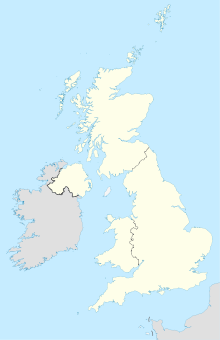
Donington (Lincolnshire)

Donington (Lincolnshire)
52.904936-0.20527300000001
Donington (Lincolnshire) (Vereinigtes Königreich)
Donington (Lincolnshire)

Donington ist ein Dorf in der englischen Grafschaft Lincolnshire. Es befindet sich 12 km nördlich von Spalding an der Fernstraße A152.

Donington ist der Geburtsort des Forschungsreisenden Matthew Flinders (1774-1814).

Weblinks

 Commons: Donington, Lincolnshire – Sammlung von Bildern, Videos und Audiodateien

Wikimedia Foundation.

Игры ⚽ Нужно решить контрольную?

Schlagen Sie auch in anderen Wörterbüchern nach:

  • Donington, Lincolnshire — Coordinates: 52°54′15″N 0°11′54″W / 52.904035°N 0.19824609°W / 52.904035; 0.19824609 …   Wikipedia

  • Donington — is the name of a number of places in England: Donington, Lincolnshire, a large village in South Holland, Lincolnshire Donington, Shropshire, a civil parish in Shropshire, England Donington on Bain, a village in Lindsey, Lincolnshire Donington le… …   Wikipedia

  • Donington — bezeichnet: ein Dorf in Lincolnshire, England, siehe Donington (Lincolnshire) ein Dorf in Lincolnshire, England, siehe Donington on Bain eine Stadt in Leicestershire, England, siehe Castle Donington eine Motorsport Rennstrecke in Leicestershire,… …   Deutsch Wikipedia

  • Donington on Bain railway station — Donington Donington railway station in 2004 Location Place …   Wikipedia

  • Donington Road railway station — was a station in Lincolnshire on the line between Spalding and Sleaford.[1] [2] In 2008 Hull Trains announced a plan in competition with national express east coast and East Midland Trains to run direct trains from Grimsby and Lincoln to London.… …   Wikipedia

  • Lincolnshire — Geografie Status: Zeremonielle und Verwaltungsgrafschaft Region: East Midlands Fläche …   Deutsch Wikipedia

  • Donington railway station — was a station in the village of Donington on Bain, Lincolnshire. [British Railways Atlas.1947. p.17] Former Services References …   Wikipedia

  • Donington on Bain — Coordinates: 53°19′44″N 0°08′43″W / 53.328830°N 0.14537439°W / 53.328830; 0.14537439 …   Wikipedia

  • Donington on Bain — 53.3289 0.14689999999999 Koordinaten: 53° 20′ N, 0° 9′ W …   Deutsch Wikipedia

  • Lincolnshire County Council elections, 2005 — Elections for Lincolnshire County Council, which covers the county of Lincolnshire were held on 5th May 2005.Election Summary Party party = Conservative Party (UK) seats = 45 gain = loss = net = seats % = votes % = votes = plus/minus = Election… …   Wikipedia

Share the article and excerpts

Direct link
Do a right-click on the link above
and select “Copy Link”