Ferguson Lake (Victoria Island)
- Ferguson Lake (Victoria Island)
-
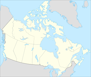
Ferguson Lake ist ein See im Südosten der Insel Victoria Island im kanadischen Territorium Nunavut. Die Wasserfläche beträgt 562 km², die Gesamtfläche einschließlich Inseln 588 km².[1] Der See liegt auf 11 m Höhe und wird vom Ekalluk River durchflossen und zur Wellington Bay, einer kleinen Bucht in der Dease Strait, entwässert.
Einzelnachweise
- ↑ a b Natural Resources Canada - The Atlas of Canada - Lakes
Wikimedia Foundation.
Schlagen Sie auch in anderen Wörterbüchern nach:
Ferguson Lake — bezeichnet folgende Seen in Kanada: Ferguson Lake (Ferguson River) in Nunavut, vom Ferguson River durchflossen Ferguson Lake (Victoria Island) in Nunavut auf der Insel Victoria Island Diese Seite ist eine Begriffsklärung zur Unters … Deutsch Wikipedia
Victoria Island (Canada) — Infobox Islands name = Victoria Island image caption = image size = locator map custom = no native name = native name link = nickname = location = Northern Canada coordinates = coord|71|0|N|110|0|W|display=inline,title|scale:5000000 archipelago … Wikipedia
Ferguson Lake (Kitikmeot Region) — Infobox lake lake name = Ferguson Lake image lake = caption lake = image bathymetry = caption bathymetry = location = southern Victoria Island, Kitikmeot, Nunavut coords = type = inflow = outflow =Ekalluk River catchment = basin countries =… … Wikipedia
Victoria — /vik tawr ee euh, tohr /; for 3 also Sp. /beek taw rddyah/, n. 1. the ancient Roman goddess of victory, identified with the Greek goddess Nike. 2. 1819 1901, queen of Great Britain 1837 1901; empress of India 1876 1901. 3. Guadalupe /gwahd l oohp … Universalium
List of localities in Victoria (Australia) — Map of Local Government Areas in Victoria This is a list of locality names and populated place names in the state of Victoria, Australia, outside the Melbourne metropolitan area. It is organised by region from the south west of the state to the… … Wikipedia
Liste der Seen in Kanada — Diese Liste enthält die 69 vom kanadischen Umweltministerium Natural Resources Canada als hauptsächliche Seen in Kanada bezeichneten Gewässer, die größer als 400 km² sind. Name Höhe Fläche Provinz Koordinaten Smallwood Reservoir 471 6527… … Deutsch Wikipedia
Navy Island Royal Naval Shipyard — Amherstburg, Ontario Type Shipyard Built 1700s In use 1763 1822 Controlled by … Wikipedia
Supreme Court of Victoria — Arms of the Supreme Court of Victora Established 1852 … Wikipedia
List of Second World War Victoria Cross recipients — 182 Victoria Crosses were awarded to 181 service personnel for gallant acts carried out during the Second World War. The following 180 recipients were awarded the Victoria Cross for the Second World War (1939–1945). Charles Upham received the… … Wikipedia
David Livingstone — For other people named David Livingstone, see David Livingstone (disambiguation). David Livingstone Born 19 March 1813(1813 03 19) Blantyre, South Lanarkshire, Scotland Died … Wikipedia