Fort Ebey State Park

Fort Ebey State Park
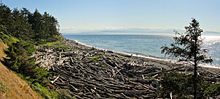
Küste im Fort Ebey State Park

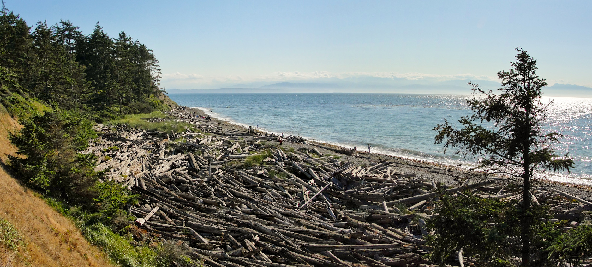
Der Fort Ebey State Park ist ein 261 Hektar großer State Park im US-Bundesstaat Washington.

Anlage

Der State Park liegt auf der Insel Whidbey Island drei Kilometer nördlich von Coupeville und zwölf Kilometer südlich von Oak Harbour im Island County. Der Park verfügt über einen Campingplatz mit 39 Stellplätzen. Der Park umfasst fünf Kilometer Küstenlinie zur Juan-de-Fuca-Straße, im Park liegt ein Süßwassersee, mehrere Kilometer Fahrrad- und Wanderwege sowie des Reste des US-Küstenforts Fort Ebey.

Geschichte

Fort Ebey wurde 1942 als Küstenbefestigung zur Verstärkung von Fort Casey gebaut. Benannt wurde das Fort nach Isaac Ebey, einem Offizier, der 1857 auf Whidbey Island von Indianern ermordet wurde. Die Bewaffnung des Forts bestand aus zwei 15,2 cm Geschützen. 1946 wurde das Fort aufgegeben. Die Geschütze wurden demontiert, die Betonfundamente der Geschützstellungen sind noch erhalten. Das Gelände des State Parks wurde ab 1965 in drei Abschnitten von der Bundesregierung erworben, seit 1991 umfasst es 261 Hektar. Der State Park wurde im Februar 1981 eröffnet.

Weblinks

48.223608333333-122.76250555556

Wikimedia Foundation.

Игры ⚽ Поможем написать реферат

Schlagen Sie auch in anderen Wörterbüchern nach:

  • Cutts Island State Park — in Pierce County, Washington is a 2 acres (0.81 ha) marine park in the Washington State Park System.[1] It comprises the entirety of Cutts Island in Carr Inlet, 0.5 miles (0.80 km) offshore from Kopachuck State Park, and is accessible… …   Wikipedia

  • McMicken Island State Park — in Mason County, Washington is a Washington State Park accessible only by boat.[1] It consists of the 11.5 acres (4.7 ha) of forested McMicken Island in south Puget Sound, including 1,661 feet (506 m) of saltwater shoreline with a… …   Wikipedia

  • Ocean City State Park — in Grays Harbor County, Washington is a camping park in the Washington State Park System.[1] It consists of 170 acres (69 ha) of ocean beach, dunes, and dense shore pine thicket on the Pacific Ocean. Available activities include fishing,… …   Wikipedia

  • Osoyoos Lake State Park — in Okanogan County, Washington is a camping park in the Washington State Park System.[1] It consists of 47 acres (19 ha) of sandy lakeshore, green lawns, and shade trees on Osoyoos Lake, in contrast with the hot, arid conditions that prevail …   Wikipedia

  • Mystery Bay State Park — is a 10 acre (4.0 ha) Washington state park on Mystery Bay, a small inlet off of Scow Bay/Kilisut Harbor on the western side of Marrowstone Island. It has 685 feet (209 m) of moorage space and is primarily intended for the use of… …   Wikipedia

  • Mount Pilchuck State Park — Fire lookout on summit View from hiking trail …   Wikipedia

  • Curlew Lake State Park — in Ferry County, Washington is one of the Washington State Parks.[1] It consists of 123 acres (50 ha) on Curlew Lake not far from a public access paleontology site (at Stonerose in Republic, Washington) and an airfield. Available activities… …   Wikipedia

  • Dash Point State Park — in King and Pierce Counties, Washington, is one of the Washington State Parks.[1] It consists of 398 acres (161 ha) including 3,301 feet (1,006 m) of saltwater shoreline on Puget Sound. Available activities include camping, beachcombing …   Wikipedia

  • Olmstead Place State Park — in Kittitas County, Washington is one of the Washington State Parks.[1] It consists of a 217 acres (88 ha) working pioneer farm. Available activities include hiking, fishing, interpretive activities, wildlife viewing, and a living farm… …   Wikipedia

  • Damon Point State Park — in Grays Harbor County, Washington is one of the Washington State Parks.[1] It consists of 61 acres (25 ha) at the southeastern tip of Ocean Shores Peninsula and consists of a 1 mile (1.6 km) by 0.5 miles (0.80 km) piece of land… …   Wikipedia

Share the article and excerpts

Direct link
Do a right-click on the link above
and select “Copy Link”