- French Island (Victoria)
-
French Island Gewässer Western Port Bay Geographische Lage 38° 21′ S, 145° 21′ O-38.34311145.35793396Koordinaten: 38° 21′ S, 145° 21′ O 

Länge 21,8 km Breite 16,2 km Fläche 170 km² Höchste Erhebung Mount Wellington
96 mEinwohner 86 (2006)
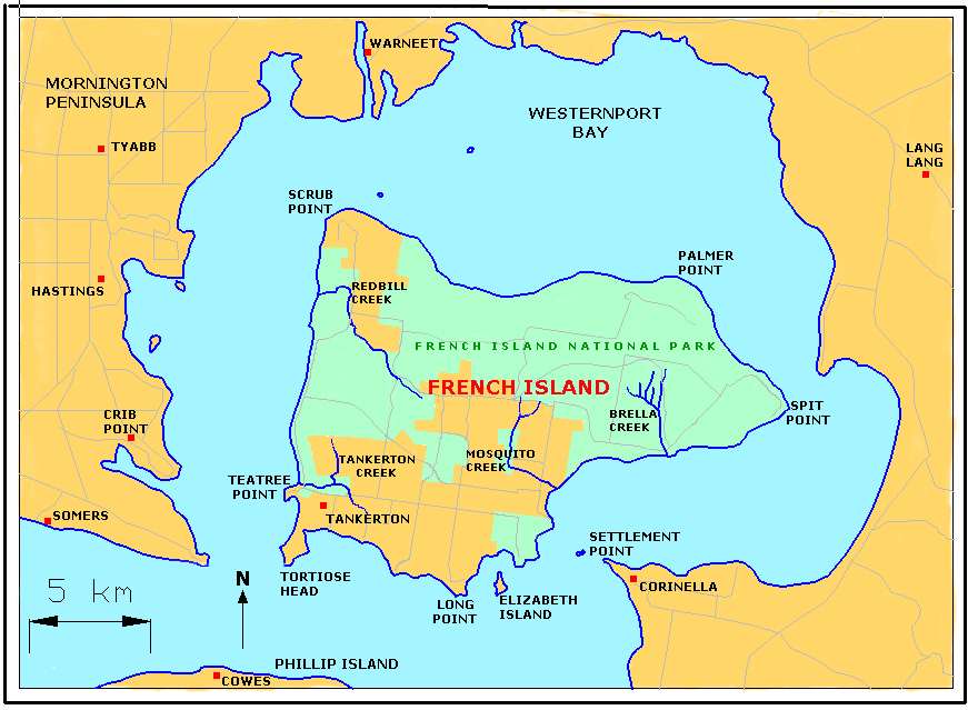
<1 Einw./km²Hauptort Tankerton Karte French Island mit dem French Island National Park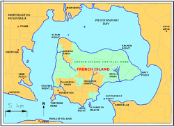
French Island ist eine Insel in der Western Port Bay 61 km südlich von Melbourne, Victoria (Australien). Rund 70 Prozent der Inselfläche von 170 km² gehören zum French-Island-Nationalpark.
Die Insel nimmt einen großen Teil der Western Port Bay ein und liegt 1,3 bis 9,4 km von deren Küste entfernt. 4,7 km weiter südlich liegt Phillip Island. Höchste Erhebung ist der Mount Wellington mit 96 Metern. French Island ist nur dünn besiedelt. Zur Volkszählung 2006 wohnten 86 Menschen auf der Insel. Als Hauptort gilt Tankerton im Südwesten.
Kategorien:- Insel (Australien und Ozeanien)
- Insel (Victoria)
- Insel (Pazifischer Ozean)
Wikimedia Foundation.