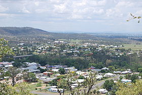
- Gayndah
-
Gayndah Staat:  Australien
Bundesstaat:  Queensland
Gegründet: 1849 Koordinaten: 25° 38′ S, 151° 36′ O-25.633333333333151.6106Koordinaten: 25° 38′ S, 151° 36′ O Höhe: 106 m Einwohner: 1.745 (2006) [1] Zeitzone: AEST (UTC+10) Postleitzahl: 4625 LGA: North Burnett Region Gayndah ist eine kleine Stadt mit etwa 1.700 Einwohnern am Burnett River im australischen Bundesstaat Queensland. Sie befindet sich 328 Kilometer nordwestlich von Brisbane und 163 Kilometer südwestlich von Bundaberg am Burnett Highway. Die Stadt ist der Sitz des Verwaltungsgebiet (LGA) North Burnett Region.
Inhaltsverzeichnis
Geschichte
Die Gegend um Gayndah wurde im Jahr 1843 erstmals von den Europäern erkundet. Die ersten Siedler ließen sich hier im Jahr 1848 nieder, ein Jahr später wurde die Stadt gegründet und das erste Postamt eröffnete 1850.[2] Von Beginn an waren die Landwirtschaft und Viehzucht die vorherrschenden Wirtschaftszweigen in diesem Gebiet. Heute ist Gayndah das Zentrum der Zitrusfrucht-Produktion in Queensland. Alle zwei Jahre findet daher das Gayndah Orange Festival statt.
Der Name der Stadt leitet sich von einem Begriff der Aborigines ab, entweder von Gu-in-dah (oder Gi-un-dah) für Donner, oder von Ngainta für eine Stelle mit Gestrüpp.[3]
Söhne und Töchter der Stadt
- Jessica Anderson (1916 - 2010), eine Schriftstellerin
Partnerstädte
Weblinks
 Commons: Gayndah, Queensland – Sammlung von Bildern, Videos und Audiodateien
Einzelnachweise
- ↑ Australian Bureau of Statistics (25. Oktober 2007): Gayndah (Urban Centre/Locality) (Englisch). 2006 Census QuickStats. Abgerufen am 16. Januar 2011.
- ↑ New South Wales Government Gazette, 19. Januar 1850, zitiert von Frew, Joan (1981). Queensland Post Offices 1842–1980 and Receiving Offices 1869–1927, S. 277. Fortitude Valley, Queensland, ISBN 0-9593973-0-2.
- ↑ Reed, A. W. (1973). Place Names of Australia, p. 102. Sydney: A. H. & A. W. Reed. ISBN 0-589-07115-7.
Kategorie:- Ort in Queensland
Wikimedia Foundation.


