Harikanassou

Harikanassou
13.2586111111112.8438888888889
Harikanassou (Niger)
Harikanassou
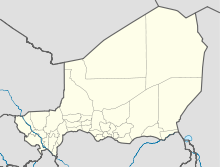
Harikanassou

Harikanassou (alternative Schreibweise: Harika-Nassou) ist eine Landgemeinde im Departement Boboye der nigrischen Region Dosso. Sie hat 26.752 Einwohner (2010).[1]

Das Gemeindegebiet ist in 36 administrative Dörfer, 14 traditionelle Dörfer und acht Weiler gegliedert.[2] Harikanassou wird vor allem von der Volksgruppe der Zarma bewohnt. Durch die Lage im Tal des Dallol Bosso liegt der Grundwasserspiegel nur wenige Meter unter der Erdoberfläche, was die Anlage von bewässerten Gemüsegärten ermöglicht. Diese werden von den Frauen der Gemeinde bewirtschaftet, die dort Salate, Bohnen, Kürbisse, Zwiebeln und Tomaten anbauen. Viele der männlichen Einwohner hingegen gehen in der Trockenzeit in die Stadt oder ins Nachbarland Nigeria, um dort Arbeit zu finden.[3] In der Trockenzeit wandert die letzte freilebende Population von Westafrikanischen Giraffen aus Kouré in das Gebiet von Harikanassou.[4]

Einzelnachweise

  1. Institut national de la statistique (Hrsg.): Annuaire statistique des cinquante ans d’indépendence du Niger. Niamey 2010 (Online-Version), S. 53.
  2. Répertoire National des Communes (RENACOM). Website des Institut National de la Statistique, abgerufen am 22. Januar 2011.
  3. Swissaid Spiegel, Nr. 2 / April 2007, S. 4 – Online-Version (pdf).
  4. Jolijn Geels: Niger. Bradt, Chalfont St Peter 2006, ISBN 1-84162-152-8, S. 134.

Wikimedia Foundation.

Игры ⚽ Поможем написать реферат

Schlagen Sie auch in anderen Wörterbüchern nach:

  • Boboye (Departement) — Boboye ist ein Departement in der Region Dosso im westafrikanischen Staat Niger. Es gliedert sich seit 2002 in die Stadt Birni N’Gaouré und die Gemeinden Fabidji, Fakara, Falmey, Guillagué, Harikanassou, Kankandi, Kiota, Koygolo und N’Gonga.[1]… …   Deutsch Wikipedia

  • Diffa —   Urban Commune   …   Wikipedia

  • N'guigmi — Nguigmi, Ngigmi Camel riders line up outside the residence of the traditional chief of Nguigmi …   Wikipedia

  • Dosso, Niger — Dosso Officials at the opening of the Regional Maternity hospital, 2008 …   Wikipedia

  • Djado Plateau — The ruined city of Djado, with nomadic women gathered in the foreground. October 1989. The Djado Plateau lies in the Sahara, in north eastern Niger. It is known for its cave art (often of large mammals long since absent from the area), but is now …   Wikipedia

  • Dakoro — is a town and commune located in the Maradi Region of Niger. Coordinates: 14°30′N 6°45′E /  …   Wikipedia

  • Dogondoutchi — Dogondoutchi …   Wikipedia

  • Mayahi — (var. Mayaki) is a town located in the Maradi Region of Niger. It is the seat of Mayahi Department and a Commune about 45km from Tessaoua. In the mid 1990s it had a population of 2,200.[1] The name Mayaki is also a rulers title among the Sudié… …   Wikipedia

  • Ouallam — is a town in southwestern Niger. It is around 300 km north of Niamey, is the capital of Ouallam Department, one of four in the Tillabery Region. Contents 1 Culture 2 Agricultural center 3 Intercommunal violence …   Wikipedia

  • Matankari — is a town in southwestern Niger. It is near the city of Niamey. Coordinates: 13°48′22″N 4°01′55″E / 13.806075°N 4.031982°E / 13.806075 …   Wikipedia

Share the article and excerpts

Direct link
Do a right-click on the link above
and select “Copy Link”