- Huon Valley Municipality
-
Huon Valley 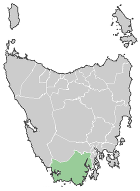
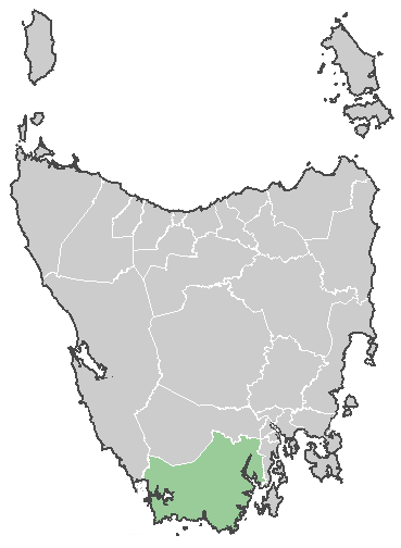
Lage des Huon Valleys in TasmanienGliederung Staat:  Australien
Bundesstaat:  Tasmanien
Verwaltungssitz: Huonville Daten und Zahlen Fläche: 5.497 km² Einwohner: 14.001 (2006) [1] Bevölkerungsdichte: 2,5 Einwohner je km² -43.033333333333147.03333333333Koordinaten: 43° 2′ S, 147° 2′ ODie Huon Valley Municipality ist ein lokales Verwaltungsgebiet (LGA) im australischen Bundesstaat Tasmanien. Das Gebiet ist 5.497 km² groß und hat etwa 14.000 Einwohner.
Huon Valley liegt an der Südspitze der Insel etwa 40 km südwestlich der Hauptstadt Hobart. Das Gebiet umfasst 47 Ortsteile und Ortschaften: Bacon Bay, Barretts Bay, Brooks Bay, Cairns Bay, Castle Forbes Bay, Crabtree, Cradoc, Deep Bay, Dover, Eggs, Franklin, Garden Island Creek, Garden Island Sands, Gardners Bay, Geeveston, Glaziers Bay, Glen Huon, Glendevie, Golden Valley, Grove, Hastings, Huonville, Ida Bay, Judbury, Lonnavale, Lower Longley, Lucaston, Lune River, Lymington, Mountain River, Nicholls Rivulet, Pelverata, Petcheys Bay, Police Point, Port Huon, Raminea, Randalls Bay, Ranelagh, Recherche, Southport, Strathblane, Surges Bay, Surveyors Bay, Verona Sands, Wattle Grove, Lower Wattle Grove, Woodstock und Upper Woodstock[2]. Auch die 1300 km südlich von Tasmanien gelegene Macquarieinsel gehört zur Huon Valley Municipality. Der Sitz des Councils befindet sich in Huonville im Nordosten der LGA, wo etwa 1900 Einwohner leben.[3]
Verwaltung
Der Huon Valley Council hat neun Mitglieder. Der Mayor (Bürgermeister), sein Deputy (Stellvertreter) und sieben Councillor werden direkt von den Bewohnern der LGA gewählt. Huon Valley ist nicht in Bezirke untergliedert.
Quellen
- ↑ Australian Bureau of Statistics (25. Oktober 2007): Huon Valley (LGA) (Englisch). 2006 Census QuickStats. Abgerufen am 6. April 2010.
- ↑ Localities by Council, Local Government Association of Tasmania
- ↑ Australian Bureau of Statistics (25. Oktober 2007): Huonville (State Suburb) (Englisch). 2006 Census QuickStats. Abgerufen am 23. März 2010.
Weblinks
Kategorie:- Local Government Area in Tasmanien
Wikimedia Foundation.