Ilhéu de Sal Rei

Ilhéu de Sal Rei

Vorlage:Infobox Insel/Wartung/Bild fehlt

Ilhéu de Sal Rei
Gewässer Atlantischer Ozean
Inselgruppe Ilhas de Barlavento
Geographische Lage 16° 10′ 10″ N, 22° 55′ 42″ W16.1694-22.928320Koordinaten: 16° 10′ 10″ N, 22° 55′ 42″ W
Ilhéu de Sal Rei (Kap Verde)
Ilhéu de Sal Rei
Länge 1,5 km
Breite 500 m
Fläche 0,6 km²
Höchste Erhebung 20 m
Einwohner (unbewohnt)

Die Ilhéu de Sal Rei (Kapverdisches Kreol: Djeu d Sal Rei) ist eine unbewohnte Insel 1 km vor der Hauptstadt Sal Rei der Insel Boavista auf den Kapverden.

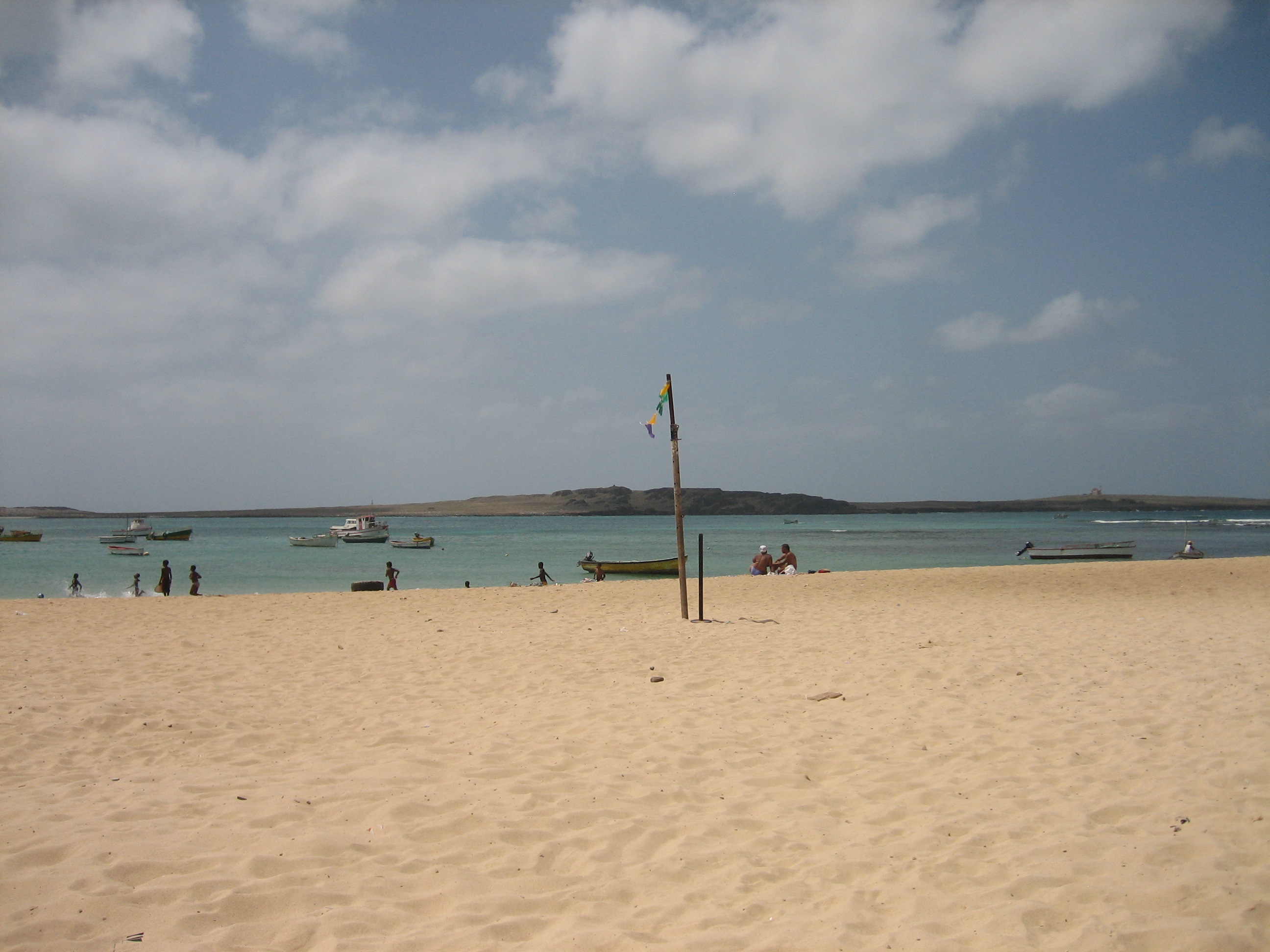
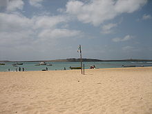
Ilhéu de Sal Rei vom Strand von Sal Rei aus gesehen

Die an der höchsten Stelle gut 20 m hohe Insel misst von Nordwest nach Südost 1,5 km und ist bis 500 m breit. Sowohl für den Hafen von Sal Rei als auch für den südlich der Inselhauptstadt gelegenen kilometerlangen Sandstrand Praia de Chaves bietet sie den Vorteil, die Brandung des Atlantiks zu reduzieren.

Auf der Insel vulkanischen Ursprungs wachsen Gras und etwas Buschwerk. Im Süden befinden sich die Überreste des portugiesischen Forts Duque de Bragança, in der Inselmitte die Ruinen eines früheren Leuchtturms.

Weblinks


Wikimedia Foundation.

Игры ⚽ Поможем сделать НИР

Schlagen Sie auch in anderen Wörterbüchern nach:

  • Ilhéu de Sal-Rei — (in Cape Verdean Creole, written in ALUPEC: Djeu d Sal Rei ) is an islet located 1 km west of Sal Rei and nearly 1 km southwest of its nearest point of Boa Vista Island in Cape Verde. They are administratively a part of the municipality of Boa… …   Wikipedia

  • Islote de Sal Rei — Ilhéu de Sal Rei Islote de Sal Rei, al fondo Localización País …   Wikipedia Español

  • Ilhéu Rabo de Junco — (in Cape Verdean Creole, written in ALUPEC: Djeu Rób d Junk ) is an islet located nearly 500 metres west of the nearest point of the island of Sal. They are administratively a part of the municipality of Sal Rei. The islet is a volcanic seamount… …   Wikipedia

  • Ilhéu de Cima (Kapverde) — Vorlage:Infobox Insel/Wartung/Höhe fehlt Ilhéu de Cima Ilhéu de Cima Gewässer Atlantischer Ozean …   Deutsch Wikipedia

  • Boa Vista (Kap Verde) — Boa Vista Landkarte Gewässer Atlantischer Ozean Inselgruppe …   Deutsch Wikipedia

  • Boa Vista, Cape Verde — Boa Vista (Portuguese meaning “good view”) is the easternmost island of Cape Verde. It is located in the Barlavento group of the archipelago. The island is known for marine turtles and traditional music, as well as its ultramarathon and its sand… …   Wikipedia

  • Geografía de Cabo Verde — Archipiélago situado en el océano Atlántico, frente a las costas de Senegal. El archipiélago se encuentra dividido en dos grupos, de acuerdo con la dirección del viento predominante. Las Islas de Barlovento incluyen las islas de Santo Antão, São… …   Wikipedia Español

  • Maio, Cape Verde — For other uses, see Maio (disambiguation). Maio Native name: Dja r’ Mai’ …   Wikipedia

  • Barlavento Islands — The Barlavento islands (literally, the Windward ), is the northern island group of Cape Verde archipelago.It can be divided in to two groups: Santo Antão, São Vicente, São Nicolau, Santa Luzia islands and Branco and Raso islets lie to the west… …   Wikipedia

  • Deserto de Viana — The Deserto de Viana, Cape Verde, (in Cape Verdean Creole: D’zert’ d’ Viana) is a desert covering most of the northwestern portion of the island and it also covers the central portion, the only parts not affected by the desert is the shoreline,… …   Wikipedia

Share the article and excerpts

Direct link
Do a right-click on the link above
and select “Copy Link”