Cayo Sabinal

Cayo Sabinal

Vorlage:Infobox Insel/Wartung/Bild fehltVorlage:Infobox Insel/Wartung/Fläche fehltVorlage:Infobox Insel/Wartung/Höhe fehlt

Cayo Sabinal
Gewässer Atlantischer Ozean
Inselgruppe Jardines del Rey
Geographische Lage 21° 43′ N, 77° 16′ W21.711944444444-77.263888888889Koordinaten: 21° 43′ N, 77° 16′ W
Cayo Sabinal (Kuba)
Cayo Sabinal
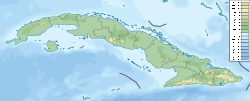
Länge 30 km
Breite 8 km

Cayo Sabinal ist eine Insel der Jardines del Rey (Gärten des Königs) an der Nordküste Kubas in der Provinz Camgüey. Die Insel ist durchschnittlich 8 km breit und ca. 30 km lang. Touristische Einrichtungen bestehen am Playa los Pinos, der durch eine 16 km lange Mautstraße, die teilweise auf einem Fahrdamm verläuft, mit dem Festland verbunden ist. Im äußersten Südosten der Insel befinden sich der schönere Strand Playa Bonita und der Playa Chuchú. Der gesamte Südteil der Insel an der Landseite ist unzugänglich.


Wikimedia Foundation.

Игры ⚽ Нужно сделать НИР?

Schlagen Sie auch in anderen Wörterbüchern nach:

  • Cayo Sabinal — Saltar a navegación, búsqueda Cayo Sabinal, es una isla de la costa norte de Cuba, que administrativamente forma parte de la provincia de Camagüey, posee 335 km² de superficie aproximadamente. Es la isla más al sur del archipiélago de Jardines… …   Wikipedia Español

  • Cayo Sabinal — Location map |Cuba1 lat = 21.8466667 long = 77.5244444 position = none float = right width = 300 Alternative caption=Location of Cayo Sabinal in CubaCayo Sabinal is a cay on the northern coast of Cuba, in the province of Camagüey. It is the… …   Wikipedia

  • Sabinal — may refer to: * Cayo Sabinal, island in Cuba * Sabinal, Texas …   Wikipedia

  • Cayo Guajaba — Saltar a navegación, búsqueda Cayo Guajaba es un cayo de la costa noreste de Cuba, que administrativamente pertenece a la provincia de Camagüey que posee 107 km² de superficie aproximadamente. Es parte del Archipiélago de los Jardines del Rey. Se …   Wikipedia Español

  • Cayo Guajaba — Location map |Cuba1 lat = 21.8466667 long = 77.5244444 position = none float = right width = 300 Alternative caption=Location of Cayo Guajaba in CubaCayo Guajaba is a cay on the northern coast of Cuba, in the province of Camagüey. It is part of… …   Wikipedia

  • Tourismus Kubas — Dieser Artikel behandelt den Tourismus in Kuba, allgemeine Informationen finden sich im Hauptartikel Kuba. Capitol in Havanna Castillo del Morro in Santiago de Cuba …   Deutsch Wikipedia

  • List of islands in the Caribbean — This is a list of islands of the Caribbean region, organized by the political territory each island belongs to.Anguilla* Anguilla * Anguillita * Blowing Rock * Cove Cay * Crocus Cay * Deadman s Cay * Dog Island * East Cay * Little Island * Little …   Wikipedia

  • Playa Santa Lucia — DMS …   Deutsch Wikipedia

  • Sabana-Camagüey Archipelago — Location map |Cuba1 lon dir = W lat dir = N lat deg = 23 lat min = 04 lat sec = 00 lon deg = 80 lon min = 09 lon sec = 00 position = none float = right width = 300 caption=Location of Sabana Camagüey Archipelago in Cuba Alternative Sabana… …   Wikipedia

  • Antillas — Imagen por satélite de la parte oriental de las Islas Antillas y el Mar Caribe Localización geográfica / administrativa …   Wikipedia Español

Share the article and excerpts

Direct link
Do a right-click on the link above
and select “Copy Link”