Kasba Lake

Kasba Lake
Kasba Lake

Photo-request.svg

Bild gesucht 

BW

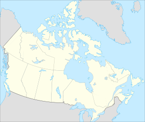
Geographische Lage Nordwest-Territorien, Nunavut (Kanada)
Abfluss Kazan River
Inseln Simons Island, Gothe Island, Kai Island, White Partridge Island
Daten
Koordinaten 60° 18′ N, 102° 7′ W60.300277777778-102.11722222222336Koordinaten: 60° 18′ N, 102° 7′ W
Kasba Lake (Kanada)
Kasba Lake
Höhe über Meeresspiegel 336 m
Fläche 1.317 km²[1]
Länge 70 kmf6
Breite 40 kmf7

Kasba Lake ist ein See an der Grenze zwischen den Nordwest-Territorien, in denen der Großteil der Seefläche liegt, und Nunavut in Kanada. Die Wasserfläche beträgt 1317 km², die Gesamtfläche einschließlich Inseln beträgt 1341 km².[1] Der See liegt auf 336 m über Meereshöhe. Der Kazan River, ein Nebenfluss des Thelon River, hat in dem See seinen Ursprung und entwässert ihn zum benachbarten östlich gelegenen See Ennadai Lake.

Einzelnachweise

  1. a b Natural Resources Canada - The Atlas of Canada - Lakes

Wikimedia Foundation.

Игры ⚽ Нужна курсовая?

Schlagen Sie auch in anderen Wörterbüchern nach:

  • Kasba Lake — Infobox lake lake name = Kasba Lake image lake = caption lake = image bathymetry = caption bathymetry = location = Northwest Territories, Nunavut coords = coord|60|17|00|N|102|00|22|W|type:waterbody region:CA|display=inline,title type = inflow =… …   Wikipedia

  • Kasba Lake — Sp Kãsbos ẽžeras Ap Kasba Lake L Kanadoje (tarp Nunavuto ir ŠV teritorijų) …   Pasaulio vietovardžiai. Internetinė duomenų bazė

  • Kasba Lake Water Aerodrome — is located on Kasba Lake, Northwest Territories, Canada and is open from June until October.References …   Wikipedia

  • Kasba Lake Airport — is located next to Kasba Lake, Northwest Territories, Canada.References …   Wikipedia

  • Snowbird Lake — Bild gesucht  BW Geographische Lage Nordwest Territorien (Kanada) …   Deutsch Wikipedia

  • Ennadai Lake — Bild gesucht  BW Geographische Lage Region Kivalliq in Nunavut (Kanada) Zuflüsse …   Deutsch Wikipedia

  • Nettilling Lake — is in the southern part of the island, being the upper of the two visible lakes. The lower lake is Amadjuak Lake. Location Baffin Island, Nunavut Territory …   Wikipedia

  • Dubawnt Lake — Location Kivalliq Region, Nunavut Coordinates 63°4′0″N …   Wikipedia

  • Henik Lake — North Henik Lake Location Kivalliq Region, Nunavut Coordinates 61°43′59″N …   Wikipedia

  • Contwoyto Lake — Location Kitikmeot Region, Nunavut Coordinates 65°40′N …   Wikipedia

Share the article and excerpts

Direct link
Do a right-click on the link above
and select “Copy Link”