Kentish Municipality

Kentish Municipality
LGATasmania Kentish.png
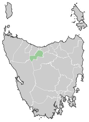
Lage der Kentish Municipality in Tasmanien
Gliederung
Staat: Australien Australien
Bundesstaat: Flag Australia tasmania.png Tasmanien
Verwaltungssitz: Sheffield
Daten und Zahlen
Fläche: 1.187 km²
Einwohner: 5.762 (2006) [1]
Bevölkerungsdichte: 4,9 Einwohner je km²
-41.383333333333146.31666666667

Die Kentish Municipality ist ein lokales Verwaltungsgebiet (LGA) im australischen Bundesstaat Tasmanien. Das Gebiet ist 1.187 km² groß und hat etwa 5.800 Einwohner.

Kentish liegt im zentralen Norden der tasmanischen Insel etwa 190 km nordwestlich der Hauptstadt Hobart. Das Gebiet umfasst 26 Ortsteile und Ortschaften: Barrington, Lower Barrington, Beulah, Lower Betilah, Cethana, Claude Road, Cowrie Park, Cradle Mountain, Erriba, West Kentish, Lake Barrington, Lorinna, Merseylea, Middlesex, Moina, Nook, Paradise, Promised Land, Railton, Roland, Sheffield, Staverton, Stoodley, Sunnyside, Wilmot und Lower Wilmot[2]. Der Sitz des Councils befindet sich in Sheffield in der Nordosthälfte der LGA, wo etwa 1400 Einwohner leben.[3]

Verwaltung

Der Kentish Council hat neun Mitglieder. Der Mayor (Bürgermeister), sein Deputy (Stellvertreter) und sieben Councillor werden direkt von den Bewohnern der LGA gewählt. Kentish ist nicht in Bezirke untergliedert.

Quellen

  1. Australian Bureau of Statistics (25. Oktober 2007): Kentish (LGA) (Englisch). 2006 Census QuickStats. Abgerufen am 6. April 2010.
  2. Localities by Council, Local Government Association of Tasmania
  3. Australian Bureau of Statistics (25. Oktober 2007): Sheffield (State Suburb) (Englisch). 2006 Census QuickStats. Abgerufen am 23. März 2010.

Weblinks


Wikimedia Foundation.

Игры ⚽ Поможем сделать НИР

Schlagen Sie auch in anderen Wörterbüchern nach:

  • Kentish — ist der Name folgender Personen: Oliver Kentish (* 1954), Cellist, Lehrer und Komponist Siehe auch: Kentish Municipality, lokales Verwaltungsgebiet (LGA) im australischen Bundesstaat Tasmanien Bahnhof Kentish Town, Bahnhof im Stadtbezirk London… …   Deutsch Wikipedia

  • Kentish Council — Infobox Australian Place | type = lga name = Kentish Council state = Tasmania caption = Kentish Council pop = 5,784 (est., June 05) [cite web|url=http://www.abs.gov.au/ausstats/abs@.nsf/Latestproducts/3218.0Main%20Features72004 05?opendocument… …   Wikipedia

  • Topiary — is the art of creating sculptures in the medium of clipped trees, shrubs and sub shrubs. The word derives from the Latin word for an ornamental landscape gardener, topiarius , creator of topia or places , a Greek word that Romans applied also to… …   Wikipedia

  • United Kingdom — a kingdom in NW Europe, consisting of Great Britain and Northern Ireland: formerly comprising Great Britain and Ireland 1801 1922. 58,610,182; 94,242 sq. mi. (244,100 sq. km). Cap.: London. Abbr.: U.K. Official name, United Kingdom of Great… …   Universalium

  • Local Government Areas of Tasmania — Local Government Areas of Tasmania, Australia This article also includes lists of towns, suburbs and localities of Tasmania.Hobart area councilsBrighton Council*Hobart suburbs: **Bridgewater Gagebrook Old Beach *Brighton *Pontville *Tea TreeCity… …   Wikipedia

  • City of Clarence — Tasmania The City of Clarence Population: 52,935 …   Wikipedia

  • Central Coast Council — Infobox Australian Place | type = lga name = Central Coast Council state = Tasmania caption = Central Coast Council pop = 20,914 (est., June 5) [cite web|url=http://www.abs.gov.au/ausstats/abs@.nsf/Latestproducts/3218.0Main%20Features72004… …   Wikipedia

  • Kingborough Council — Tasmania Kingborough Council Population: 34 …   Wikipedia

  • City of Glenorchy — Tasmania Population: 44,716 …   Wikipedia

  • Brighton Council — Tasmania Brighton Council Population: 16,358 …   Wikipedia

Share the article and excerpts

Direct link
Do a right-click on the link above
and select “Copy Link”