- Khancoban
-
Khancoban 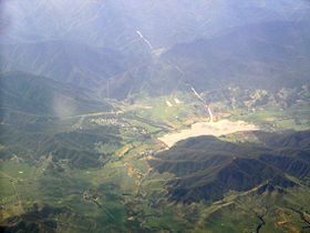
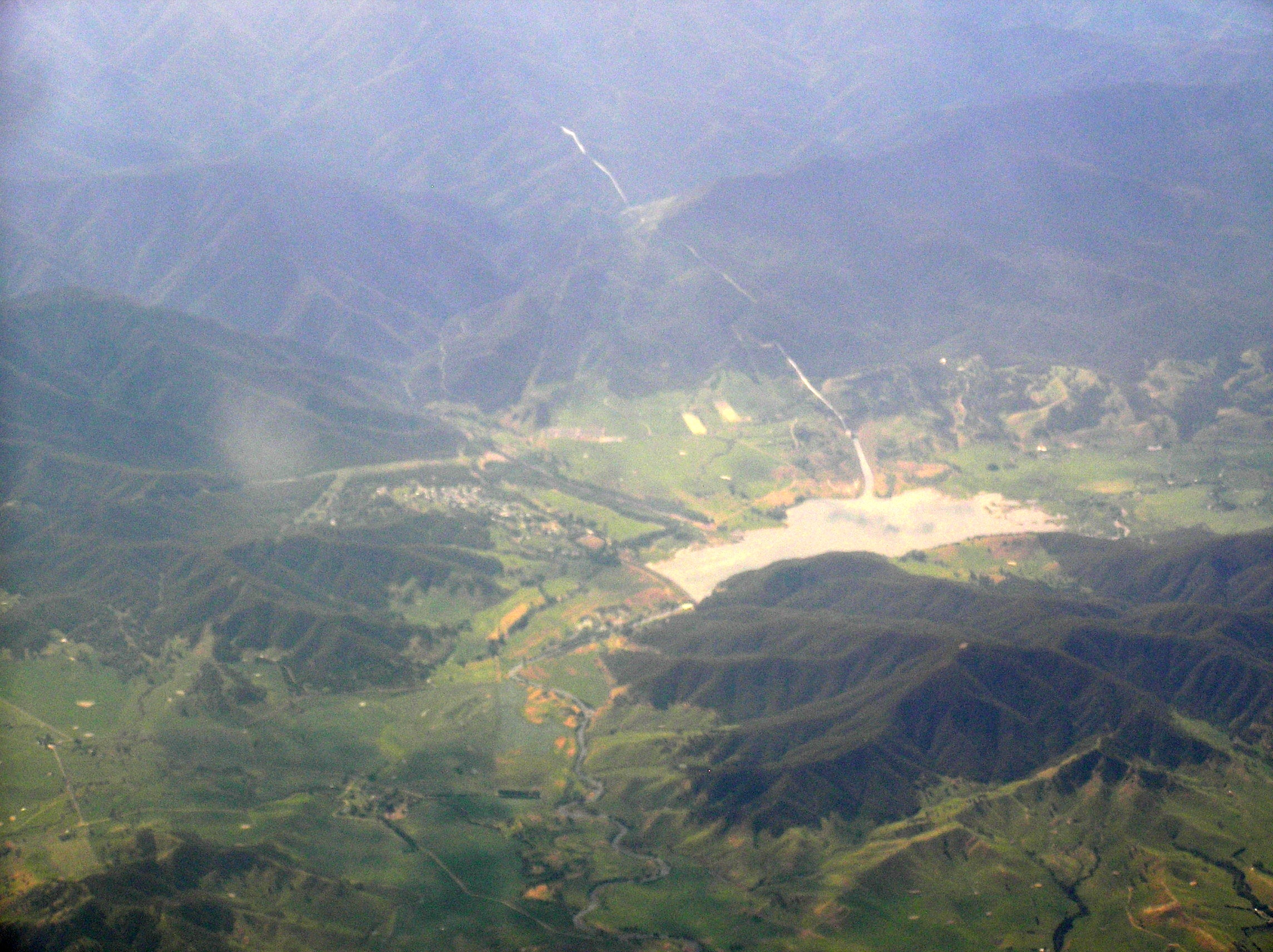
Luftaufnahme des Orts mit Khancoban-StauseeStaat:  Australien
Bundesstaat:  New South Wales
Koordinaten: 36° 13′ S, 148° 8′ O-36.22148.12694444444337Koordinaten: 36° 13′ S, 148° 8′ O Höhe: 337 m Einwohner: 281 (2006) [1] Zeitzone: AWST (UTC+8) Postleitzahl: 2642 LGA: Tumbarumba Shire Council 

Khancoban Khancoban ist eine Ortschaft auf der westlichen Seite der Snowy Mountains in New South Wales, Australien. Der Ort befindet sich 567 Kilometer von Sydney, 453 Kilometer von Melbourne und 151 Kilometer von Albury entfernt. Der nächstgelegene Ort ist Corryong in einer Entfernung von 20 Kilometern, der im Bundesstaat Victoria liegt.
Inhaltsverzeichnis
Ortschaft
In Khancoban befindet sich seit dem 7. November 1876 eine Poststation.[2] Der Ort liegt im Kosciuszko-Nationalpark und wird von Touristen häufig aufgesucht, die dort wandern oder Sport treiben, ferner ist ein Golfplatz vorhanden. Am Khancoban-Stausee neben Khancoban gibt es eine Bootsrampe und um den Ort Aussichtsplätze.[3] Der am Ort liegende Stausee für das Wasserkraftsystem bildet den Ausgangspunkt zum Fischen von Forellen, für Boots- und Wassersport, wie Rafting, Kanufahrten und Wasserski.
Khancoban hat eine Straßenverbindung nach Jindabyne, Cooma und zum Skiresort in Thredbo.
Snowy-Mountains-System
Die Ortschaft liegt am Swampy Plain River, der durch die Khancoban Pondage fließt. In der Nähe des Orts befinden sich die Murray Power Stationen 1 und 2, die aus den Wassern des Snowy-Mountains-Systems Strom erzeugen. Die Ortschaft Khancoban wurde für die Arbeiter des Snowy-Mountains-System in den Jahren von 1949 bis 1973 ausgebaut.
Weblinks
 Commons: Khancoban, New South Wales – Sammlung von Bildern, Videos und Audiodateien
Einzelnachweise
- ↑ Australian Bureau of Statistics (25. Oktober 2007): Khancoban (L) (Urban Centre/Locality) (Englisch). 2006 Census QuickStats. Abgerufen am 25. Oktober 2007.
- ↑ Information auf premierpostal.com. Abgerufen am 24. Juni 2010
- ↑ Webseite über Khancoban auf snowymountains.com.au. Abgerufen am 24. Juni 2010
Kategorien:- Snowy-Mountains-System
- Ort in New South Wales

Wikimedia Foundation.