Kidwelly Castle

Kidwelly Castle
Kidwelly Castle

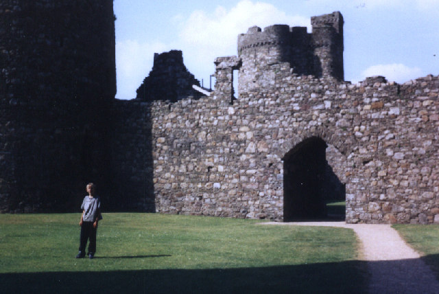
Kidwelly Castle ist die Ruine einer Burg in der walisischen Grafschaft Carmarthenshire, die im 12. bis 15. Jahrhundert erbaut wurde.

Beschreibung

Der innere Burghof besitzt vier runde Wehrtürme und ist auf drei Seiten von einem Zwinger umgeben. Im Osten fehlt die Zwingermauer, da dort der Hang genug Schutz bietet (Allen Brown, Seiten 78-79). Wie bei walisischen Burgen aus dieser Zeit üblich, ist das Torhaus besonders stark befestigt.

Literatur

Reginald Allen Brown: Allen Brown's English castles. ISBN 978-1-84383-069-6

Weblinks

 Commons: Kidwelly Castle – Sammlung von Bildern, Videos und Audiodateien
51.739496783611-4.3057072163889

Wikimedia Foundation.

Игры ⚽ Поможем написать курсовую

Schlagen Sie auch in anderen Wörterbüchern nach:

  • Kidwelly Castle — ( cy. Castell Cydweli ) is an Anglo Norman castle overlooking the river Gwendraeth and the town of Kidwelly, Carmarthenshire, Wales. The present remains of the castle include work from about 1200 to about 1476. Created as a defence against the… …   Wikipedia

  • Kidwelly — Coordinates: 51°44′11″N 4°18′26″W / 51.73634°N 4.30714°W / 51.73634; 4.30714 …   Wikipedia

  • Ogmore Castle — and grounds Ogmore Castle (alternate: Ogor Castelle; or Castell Ogwr) is located near the village of Ogmore by Sea, south of the town of Bridgend in Glamorgan, South Wales. It is situated on the south bank of the River Ewenny and the east bank of …   Wikipedia

  • Firing Line: Cardiff Castle Museum of the Welsh Soldier — Coordinates: 51°28′55″N 3°10′52″W / 51.482°N 3.181°W / 51.482; 3.181 …   Wikipedia

  • Carmarthenshire — Not to be confused with Caernarfonshire. County of Carmarthenshire Sir Gaerfyrddin Geography Area Total  % Water …   Wikipedia

  • Llanelli — infobox UK place static static image caption=Ymlaen Llanelli Forward Llanelli latitude= 51.683471 longitude= 4.161369 country = Wales welsh name= official name= Llanelli unitary wales= Carmarthenshire population= 46,358 [Llanelli Urban Area,… …   Wikipedia

  • Newcastle Emlyn — Coordinates: 52°02′N 4°28′W / 52.04°N 4.47°W / 52.04; 4.47 …   Wikipedia

  • Carmarthen — Not to be confused with Caernarfon or Cwmafan. Coordinates: 51°51′22″N 4°18′58″W / 51.856°N 4.316°W / 5 …   Wikipedia

  • St Clears — Coordinates: 51°49′14″N 4°30′15″W / 51.82043°N 4.50424°W / 51.82043; 4.50424 …   Wikipedia

  • Cuisine of Carmarthenshire — Known as “The Garden of Wales”, [1] Carmarthenshire is a county of rich, fertile farmland and productive seas and estuaries, that give the county a range of foods that motivate many home cooks and restaurateurs. [2] There is a local tradition in… …   Wikipedia

Share the article and excerpts

Direct link
Do a right-click on the link above
and select “Copy Link”