King Island Airport — Infobox Airport name = King Island Airport nativename = nativename a = nativename r = image width = caption = IATA = KNS ICAO = YKII type = Public owner = operator = King Island Council city served = location = Currie, Tasmania elevation f = 132… … Wikipedia
King Island — ist der Name mehrerer Inseln in den Vereinigten Staaten: King Island (Alaska) King Island (Illinois) King Island (Kalifornien) King Island (Aroostook County, Maine) King Island (Penobscot County, Maine) King Island (Montana) King Island (Forest… … Deutsch Wikipedia
King Island — may refer to:Places *King Island, Alaska in the Bering Sea west of Alaska, United States *King Island (British Columbia), Canada *King Island (Saskatchewan), Canada (formerly known as Devil s Island). *King Island (Tasmania) off the coast of… … Wikipedia
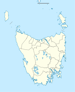
King Island (Tasmania) — Infobox Islands name = King Island image caption = King Island from space, April 1993 (South is at top) locator native name = native name link = location = Tasmania coordinates= 39°52 S 143°59 E area = 1 098 km² (424 sq mi) highest mount = Mount… … Wikipedia
King Island Airlines — Infobox Airline airline = King Island Airlines logo size = fleet size = 5 [http://www.casa.gov.au/casadata/regsearch/airsresults.asp?VHin= framein=all manuin= modelin= regholdin= regopin=MATAKANA+NOMINEES+PTY.+LTD. serialin= num results=10 Search … Wikipedia
Orcas Island Airport — IATA: ESD – ICAO: KORS – FAA LID: ORS Summary Airport type Public Owner Port of Orcas … Wikipedia
Murray Island Airport — IATA: MYI – ICAO: YMUI Summary Airport type Public Location Murray Island, Queensland, Australia … Wikipedia
Coconut Island Airport — (IATA: CNC[1], ICAO: YCCT[2]) is an airport located on Coconut Island (Poruma Island) in Queensland, Australia. Airlines and destinations Aero Tropics Air Services (Horn Island, Warraber Island, Yam Island, Yorke Island) Regional Pacific… … Wikipedia
Mornington Island Airport — (IATA: ONG, ICAO: YMTI) is an airport on Mornington Island, Queensland, Australia. in 2006 the airport received $200,853 in funds to improve security.[1] Airlines and destinations Airlines Destinations Skytrans Airlines Burketown, Doomadgee … Wikipedia
Darnley Island Airport — (IATA: NLF) is an airport in Darnley Island, Queensland, Australia. Airlines and destinations Aero Tropics Air Services (Horn Island, Murray Island, Yorke Island) Regional Pacific Airlines (Yorke Island) Coordinates … Wikipedia