- King Island Municipality
-
King Island Municipality 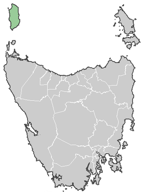
Lage der King Island in TasmanienGliederung Staat:  Australien
Bundesstaat:  Tasmanien
Verwaltungssitz: Currie Daten und Zahlen Fläche: 1.098 km² Einwohner: 1.639 (2006) [1] Bevölkerungsdichte: 1,5 Einwohner je km² -39.933333333333143.85Koordinaten: 39° 56′ S, 143° 51′ ODie King Island Municipality ist ein lokales Verwaltungsgebiet (LGA) im australischen Bundesstaat Tasmanien. Das Gebiet ist 1.098 km² groß und hat etwa 1.600 Einwohner.
King Island ist eine Insel nordwestlich der tasmanischen Hauptinsel. 14 Ortsteile und Ortschaften liegen auf der Insel: Currie, Egg Lagoon, Grassy, Loorana, Lymwood, Naracoopa, Pearshape, Pegarah, Reekara, Sea Elephant, Surprise Bay, Wickharn, Yambacoona und Yarra Creek[2]. Der Sitz des Councils befindet sich in Currie an der Westküste der Insel, wo etwa 750 Einwohner leben.[3]
Verwaltung
Der King Island Council hat neun Mitglieder. Der Mayor (Bürgermeister), sein Deputy (Stellvertreter) und sieben Councillor werden direkt von den Bewohnern der LGA gewählt. King Island ist nicht in Bezirke untergliedert.
Quellen
- ↑ Australian Bureau of Statistics (25. Oktober 2007): King Island (LGA) (Englisch). 2006 Census QuickStats. Abgerufen am 6. April 2010.
- ↑ Localities by Council, Local Government Association of Tasmania
- ↑ Australian Bureau of Statistics (25. Oktober 2007): Currie (State Suburb) (Englisch). 2006 Census QuickStats. Abgerufen am 23. März 2010.
Weblinks

Wikimedia Foundation.