- La Vernarède
-
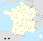
La Vernarède Region Languedoc-Roussillon Département Gard Arrondissement Alès Kanton Génolhac Koordinaten 44° 17′ N, 4° 1′ O44.2897222222224.0097222222222Koordinaten: 44° 17′ N, 4° 1′ O Höhe 307–644 m Fläche 5,53 km² Einwohner 360 (1. Jan. 2008) Bevölkerungsdichte 65 Einw./km² Postleitzahl 30530 INSEE-Code 30345 Website http://la.vernarede.pagesperso-orange.fr/topic/index.html

OrtseingangLa Vernarède ist eine französische Gemeinde mit 360 Einwohnern (Stand 1. Januar 2008) im Département Gard in der Region Languedoc-Roussillon.
Geografie
La Vernarède liegt in den Cevennen westlich des Luech.
Weblinks
Commons: La Vernarède – Sammlung von Bildern, Videos und AudiodateienAujac | Bonnevaux | Chambon | Chamborigaud | Concoules | Génolhac | La Vernarède | Malons-et-Elze | Ponteils-et-Brésis | Portes | Sénéchas
Wikimedia Foundation.
Schlagen Sie auch in anderen Wörterbüchern nach:
La Vernarede — La Vernarède La Vernarède Pays … Wikipédia en Français
La Vernarède — L entrée du village … Wikipédia en Français
La Vernarède — País … Wikipedia Español
La Vernarède — is a commune in the Gard department in southern France.ee also*Communes of the Gard departmentReferences Based on the article in the French Wikipedia … Wikipedia
Chambon (Gard) — Pour les articles homonymes, voir Chambon. 44° 18′ 10″ N 4° 01′ 07″ E … Wikipédia en Français
Portes (Gard) — Pour les articles homonymes, voir Portes. 44° 16′ 17″ N 4° 01′ 15″ E … Wikipédia en Français
Chamborigaud — 44° 18′ 08″ N 3° 58′ 43″ E / 44.3022, 3.9786 … Wikipédia en Français
Gare de Chamborigaud — Chamborigaud Localisation Pays France Commune Chamborigaud Adresse Route de Villefort 30530 Chamborigaud Coordonnées géographiques … Wikipédia en Français
Genolhac — Génolhac Génolhac Pays France … Wikipédia en Français
Sainte-Cécile-d'Andorge — Pour les articles homonymes, voir Sainte Cécile. 44° 15′ 10″ N 3° 58′ 37″ E … Wikipédia en Français