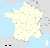
- Lamorlaye
-
Lamorlaye Region Picardie Département Oise Arrondissement Senlis Kanton Chantilly Koordinaten 49° 9′ N, 2° 26′ O49.1552.440833333333334Koordinaten: 49° 9′ N, 2° 26′ O Höhe 34 m (23–110 m) Fläche 15,34 km² Einwohner 9.422 (1. Jan. 2008) Bevölkerungsdichte 614 Einw./km² Postleitzahl 60260 INSEE-Code 60346 Website www.ville-lamorlaye.fr/ Lamorlaye ist eine französische Gemeinde mit 9422 Einwohnern (Stand 1. Januar 2008) im Departement Oise, Region Picardie. Seine Einwohner werden Morlacuméen genannt.

Die Nachbargemeinden sind Gouvieux im Norden, Chantilly im Nordosten, Coye-la-Forêt im Südosten, Asnières-sur-Oise im Süden sowie Boran-sur-Oise im Westen. Lamorlaye befindet sich auf der Grenze zwischen den Regionen Picardie und Île-de-France.
Weblinks
Schlagen Sie auch in anderen Wörterbüchern nach:
Lamorlaye — País … Wikipedia Español
Lamorlaye — is a village and commune in the Oise département of northern France.ee also*Communes of the Oise department … Wikipedia
Lamorlaye — 49° 09′ 20″ N 2° 26′ 30″ E / 49.1555555556, 2.44166666667 … Wikipédia en Français
Lamorlaye — Original name in latin Lamorlaye Name in other language Lamorlaye State code FR Continent/City Europe/Paris longitude 49.16246 latitude 2.44687 altitude 60 Population 8540 Date 2012 01 18 … Cities with a population over 1000 database
Lys-Chantilly — Lamorlaye Lamorlaye Pays Franc … Wikipédia en Français
Chantilly — Pour les articles homonymes, voir Chantilly (homonymie). 49° 11′ 35″ N 2° 27′ 55″ E … Wikipédia en Français
Coye-la-Forêt — 49° 08′ 34″ N 2° 28′ 27″ E / 49.1427777778, 2.47416666667 … Wikipédia en Français
Chantilly — Chantilly … Deutsch Wikipedia
Forêt de Chantilly — Le carrefour de la Table, au centre de la forêt en hiver. Localisation Coordonnées … Wikipédia en Français
Gouvieux — 49° 11′ 18″ N 2° 25′ 01″ E / 49.1883333333, 2.41694444444 … Wikipédia en Français