Leagrave

Leagrave

Leagrave ist ein Vorort von Luton in Bedfordshire, England, ganz in der Nähe vom Motorway M1 und dem Flughafen London-Luton.

Bahnhof

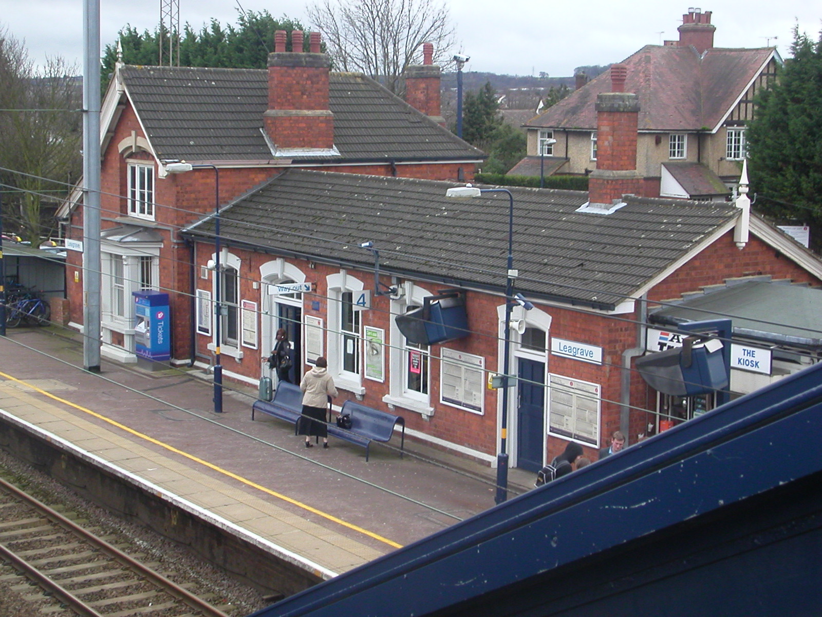
Bahnsteig 4 des Bahnhofs von Leagrave
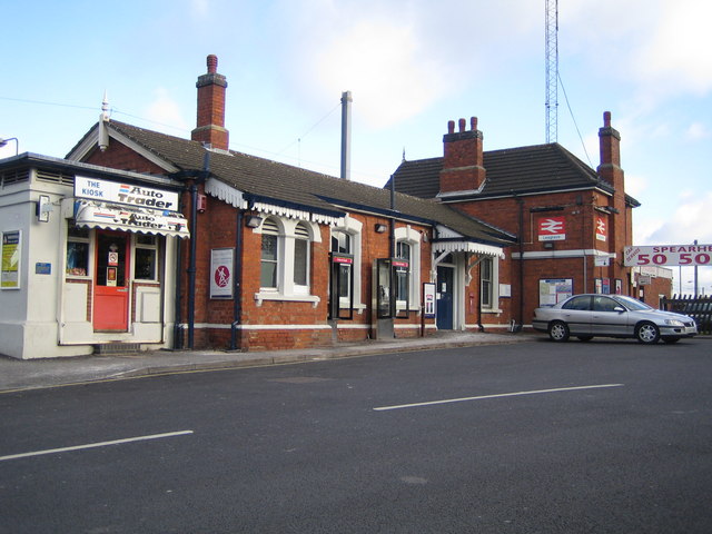
Bahnhofsgebäude

Der Bahnhof von Leagrave befindet sich an der auch von Thameslink benutzten Midland Main Line 54 km (33 ¾ Meilen) nördlich vom Londoner Bahnhof St Pancras. Die Station wird von First Capital Connect verwaltet und wird von der Thameslink-Zügen angefahren.

Die Station wurde 1868 von der Midland Railway bei der Verlängerung nach St. Pancras gebaut. Das alte Midland-Bahnhofsgebäude existiert noch und wurde in den 1980er Jahren restauriert.[1]

Einzelnachweise

  1. Radford, B., (1983) Midland Line Memories: a Pictorial History of the Midland Railway Main Line Between London (St Pancras) & Derby London: Bloomsbury Books

Wikimedia Foundation.

Игры ⚽ Нужен реферат?

Schlagen Sie auch in anderen Wörterbüchern nach:

  • Leagrave — infobox UK place country = England latitude= 51.903 longitude= 0.466 official name= Leagrave os grid reference= TL0523 population= 11,580 (est.) [ [http://www.bedscc.gov.uk/BedsCC/SDimr2.nsf/Web/Thepage/Population+Estimates+and+Forecasts+2005… …   Wikipedia

  • Leagrave (disambiguation) — Leagrave is a village in Bedfordshire, England.Leagrave may also refer to: * Leagrave Bench, a style of traditional furniture * Leagrave Railway Station …   Wikipedia

  • Leagrave railway station — Infobox UK station name = Leagrave manager = First Capital Connect locale = Leagrave code = LEA borough = Luton usage0405 = 1.342 usage0506 = 1.413 usage0607 = 1.525 platforms = 4 start = circa 1856Leagrave railway station is located in Leagrave …   Wikipedia

  • Luton — For other uses, see Luton (disambiguation). Borough of Luton   Town, Borough Unitary authority   Luton Town Hall …   Wikipedia

  • Marsh Farm — Not to be confused with Marsh Farm Junction or Inner Marsh Farm. Coordinates: 51°55′01″N 0°27′11″W / 51.9169°N 0.453°W …   Wikipedia

  • Hockwell Ring — infobox UK place country = England latitude= 51.904 longitude= 0.475 official name= Hockwell Ring os grid reference= TL0523 population= 4,000 (est.) region= East of England unitary england= Luton lieutenancy england= Bedfordshire constituency… …   Wikipedia

  • Limbury — infobox UK place country = England latitude= 51.909 longitude= 0.447 official name= Limbury civil parish= Limbury os grid reference= TL0624 population= 7,540 (est.). [ [http://www.bedscc.gov.uk/BedsCC/SDimr2.nsf/Web/Thepage/Population+Estimates+an… …   Wikipedia

  • Lea Valley Walk — Infobox Hiking trail Name=Lea Valley Walk Photo=WardownLake.jpg Caption=The trail goes through Wardown Park Location= South East England Designation= Length=Convert|50|mi|km|0 Start/End Points=Leagrave Limehouse Basin Use=Hiking,Cycling,Angling,… …   Wikipedia

  • Midland Main Line — This article is about the railway line. For the former train operating company, see Midland Mainline. Midland Main Line East Midlands Trains HST at Dore. Overview …   Wikipedia

  • River Lee (England) — Geobox River name = Lee/Lea map size = map caption = other name = other name1 = country = United Kingdom country1 = region = region1 = city = city1 = length = 68 length imperial = watershed = watershed imperial = discharge location = discharge… …   Wikipedia

Share the article and excerpts

Direct link
Do a right-click on the link above
and select “Copy Link”