Liboré

Liboré
13.4047222222222.1913888888889
Liboré (Niger)
Liboré
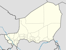
Liboré

Liboré ist eine Landgemeinde im Departement Kollo der nigrischen Region Tillabéri. Sie hat 23.029 Einwohner (2010).[1]

Liboré liegt am linken Ufer des Flusses Niger und grenzt an die nigrische Hauptstadt Niamey. Das Gemeindegebiet besteht aus zwölf administrativen Dörfern und zehn Weilern.[2] Von 2001 bis 2002 war Liboré vorübergehend als sechster Stadtbezirk in Niamey eingemeindet. Zu den Einwohnern von Liboré zählen Angehörige der Volksgruppen Zarma, Fulbe und Hausa sowie eine malische Minderheit. Die Landwirtschaft spielt eine wichtige Rolle in der Gemeinde. Neben dem Anbau von Reis, Hirse und Augenbohnen werden Viehzucht und Fischerei betrieben.[3]

Weblinks

Einzelnachweise

  1. Institut national de la statistique (Hrsg.): Annuaire statistique des cinquante ans d’indépendence du Niger. Niamey 2010 (Online-Version), S. 58.
  2. Répertoire National des Communes (RENACOM). Website des Institut National de la Statistique, abgerufen am 22. Januar 2011.
  3. Kokou Henri Motcho: La réforme communale de la communauté urbaine de Niamey. In: Revue de géographie alpine. Nr. 92, 2004. S. 120.

Wikimedia Foundation.

Игры ⚽ Поможем написать курсовую

Schlagen Sie auch in anderen Wörterbüchern nach:

  • Kollo (Departement) — Westafrikanische Giraffen in Kouré Kollo ist ein Departement in der Region Tillabéri im westafrikanischen Staat Niger. Es erstreckt sich über eine Fläche von 10.002 km². Es gliedert sich seit 2002 in die Stadt Kollo und die Gemeinden Bitinkodji… …   Deutsch Wikipedia

  • Niamey — Communauté Urbaine de Niamey Niamey …   Deutsch Wikipedia

  • Diffa —   Urban Commune   …   Wikipedia

  • N'guigmi — Nguigmi, Ngigmi Camel riders line up outside the residence of the traditional chief of Nguigmi …   Wikipedia

  • Dosso, Niger — Dosso Officials at the opening of the Regional Maternity hospital, 2008 …   Wikipedia

  • Djado Plateau — The ruined city of Djado, with nomadic women gathered in the foreground. October 1989. The Djado Plateau lies in the Sahara, in north eastern Niger. It is known for its cave art (often of large mammals long since absent from the area), but is now …   Wikipedia

  • Dakoro — is a town and commune located in the Maradi Region of Niger. Coordinates: 14°30′N 6°45′E /  …   Wikipedia

  • Dogondoutchi — Dogondoutchi …   Wikipedia

  • Mayahi — (var. Mayaki) is a town located in the Maradi Region of Niger. It is the seat of Mayahi Department and a Commune about 45km from Tessaoua. In the mid 1990s it had a population of 2,200.[1] The name Mayaki is also a rulers title among the Sudié… …   Wikipedia

  • Communes of Niger — Niger This article is part of the series: Politics and government of Niger Constitution President …   Wikipedia

Share the article and excerpts

Direct link
Do a right-click on the link above
and select “Copy Link”