- Maatsuyker Island
-
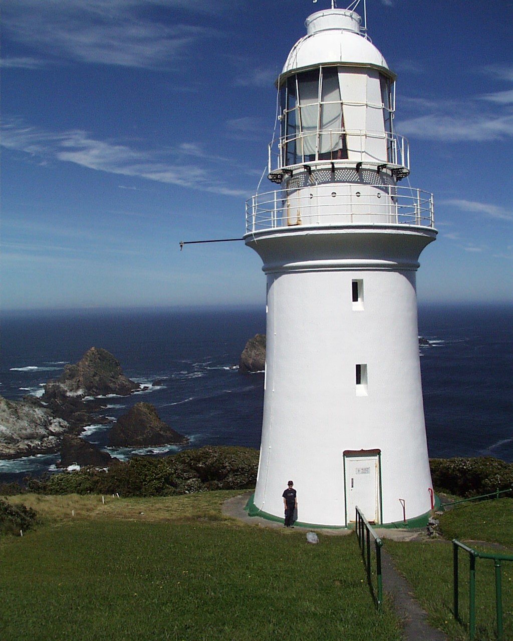
Maatsuyker Island Der Leuchtturm der Insel, im Hintergrund die Needle Rocks
Gewässer Südpazifik Inselgruppe Maatsuyker-Inseln Geographische Lage 43° 39′ 18″ S, 146° 16′ 23″ O-43.655146.27305555556284Koordinaten: 43° 39′ 18″ S, 146° 16′ 23″ O 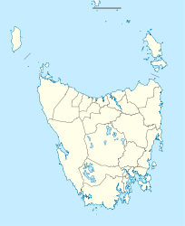

Länge 2,5 km Breite 1,3 km Fläche 1,86 km² Höchste Erhebung 284 m Einwohner (unbewohnt) Karte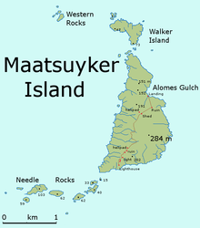
Maatsuyker Island ist die Hauptinsel der Maatsuyker-Inseln. Sie ist die zweitgrößte der Inselgruppe und hat eine Fläche von 186 Hektar. Nahe an der Südküste Tasmaniens gelegen ist sie auch Teil des Southwest-Nationalparks.
Klima
Wegen der nicht unerheblichen Distanz zum Äquator ist das Klima auf der Insel die meiste Zeit des Jahres ziemlich kühl und kälter als in Australien. Die Temperatur, die die meiste Zeit des Jahres auf der Insel vorherrscht, beträgt 10° Celsius. Wind ist auf der Insel so gut wie immer vorzufinden.
Flora und Fauna
Die Vegetation auf der Insel besteht zu einem Großteil aus Südseemyrte, die die meisten Flächen auf der Insel bedeckt. Sie kann bis zu einer Höhe von 6 Metern wachsen.
Auf der Insel wurden vor allem schon einige Meeres- und Watvögel gefunden, wie z.B. Zwergpinguine, den Kurzschwanz-Sturmtaucher, den Dunklen Sturmtaucher, Feensturmvögel, Tauchsturmvögel, Dickschnabelmöven oder der Ruß-Austernfischer, außerdem die Maus Antechinus minimus. Verschiedene Robbenarten brüten auf der Insel.
Weblinks
Inseln der Maatsuyker-InselnInseln: De Witt | Flat Top | Flat Witch | Maatsuyker | Round Top | Walker | Felsformationen: Needle Rocks | Western Rocks
Wikimedia Foundation.
Schlagen Sie auch in anderen Wörterbüchern nach:
Maatsuyker Island — is a 186 ha island in south eastern Australia. It is part of the Maatsuyker Island Group, lying close to the southern end of the south western coast of Tasmania. It is also part of the Southwest National Park, and thus within the Tasmanian… … Wikipedia
Maatsuyker Island Lighthouse — mit den Needle Rocks (links) Das Maatsuyker Island Lighthouse ist der am weitesten südlich liegende Leuchtturm Australiens, der an der südlichen Spitze des Maatsuyker Island liegt. Dieses Bauwerk war auch Australiens letzter bemannter Leuchtturm … Deutsch Wikipedia
Maatsuyker Islands — Aerial view of the group from the west. Needle Rocks are on the right. Just to the left of them is Maatsuyker Island. De Witt is the larger island on the left. Tasmania and South East Cape are in the background. View was computer generated from… … Wikipedia
Maatsuyker-Inseln — Lage der Maatsuyker Inseln; oben links die tasmanische Südküste Gewässer Pazifischer Ozean … Deutsch Wikipedia
De Witt Island — De Witt Island, also known as Big Witch, is a 517 hectares (2.00 sq mi) island in south eastern Australia. It is the largest of the Maatsuyker Island Group, lying close to the southern end of the south western coast of Tasmania. Its… … Wikipedia
Walker Island — is a 15 ha island in south eastern Australia. It lies close to the northern end of Maatsuyker Island and is part of the Maatsuyker Island Group, lying close to the southern end of the south western coast of Tasmania. It is also part of the… … Wikipedia
Rottnest Island — Western Australia Rottnest Island from space Population: 300 (up to … Wikipedia
Maria Island — Native name: Toarra Marra Monah Geography Location Off Tasmania s east coast Coordinates … Wikipedia
Louisa Island (Tasmania) — Louisa Island is an irregularly shaped 23 ha island in south eastern Australia. It is part of the Maatsuyker Island Group, lying close to the southern end of the south western coast of Tasmania. Its highest point is 80 m asl and, at low tide, it… … Wikipedia
Flat Witch Island — Flat Witch Island, also known as Little Witch, is a 64 ha island in south eastern Australia. It is part of the Maatsuyker Island Group, lying close to the southern end of the south western coast of Tasmania. Its highest point is over 100 m asl.… … Wikipedia
Maatsuyker Island


18+
© Academic, 2000-2024
- Kontaktieren Sie uns: Unterstützung, Werbung
Wörterbücher Export, schritte mit PHP, Joomla, Drupal, WordPress, MODx.