- De Witt Island
-
De Witt Island De Witt ist links im Bild vor der Festlandsküste
Gewässer Südpazifik Inselgruppe Maatsuyker-Inseln Geographische Lage 43° 35′ 51″ S, 146° 21′ 35″ O-43.5975146.35972222222354Koordinaten: 43° 35′ 51″ S, 146° 21′ 35″ O 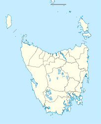

Länge 3,3 km Breite 2,4 km Fläche 5,17 km² Höchste Erhebung 354 m ü. NN Einwohner (unbewohnt) Karte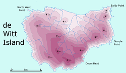
De Witt Island ist die größte Insel der Maatsuyker-Inseln und hat eine Fläche von 517 Hektar. Nahe der Südküste Tasmaniens gelegen gehört sie auch zum Southwest-Nationalpark. Obwohl sie derzeit unbewohnt ist, wurde sie doch lange Zeit genutzt, vor allem zur Holzgewinnung, aber auch als gelegentliche Wohnstätte.
Flora und Fauna
Die Insel ist in großen Zügen mit Eukalyptus-Bäumen bewaldet. An manchen Stellen kann man auch die Tasmanische Scheinulme und niedere Vegetation finden.
Auf der Insel gibt es eine etwas reichere Artenvielfalt, so befinden sich vor allem Meeres- und Watvögel, wie z.B. Zwergpinguine, den Kurzschwanz-Sturmtaucher, den Dunklen Sturmtaucher, Feensturmvögel, Tauchsturmvögel, Dickschnabelmöven oder der Ruß-Austernfischer, ebenso gibt es Schwalbensittiche. Säugetiere sind auch vertreten, darunter der Rotbauchfilander, Kaninchenkängurus oder Ratten. Des Weiteren finden sich mit verschiedenen Arten von Skinken Reptilien auf der Insel.
Inseln der Maatsuyker-InselnInseln: De Witt | Flat Top | Flat Witch | Maatsuyker | Round Top | Walker | Felsformationen: Needle Rocks | Western Rocks
Wikimedia Foundation.
Schlagen Sie auch in anderen Wörterbüchern nach:
De Witt Island — De Witt Island, also known as Big Witch, is a 517 hectares (2.00 sq mi) island in south eastern Australia. It is the largest of the Maatsuyker Island Group, lying close to the southern end of the south western coast of Tasmania. Its… … Wikipedia
De Witt — Not to be confused with DeWitt (disambiguation), Dewitt (disambiguation), or de Wit. De Witt can refer to: Contents 1 Places 2 People 2.1 … Wikipedia
De Witt Park Historic District — U.S. National Register of Historic Places U.S. Historic district … Wikipedia
Ernst Witt — (June 26 1911 July 3 1991) was a German mathematician born on the island of Als, (German: Alsen ). Shortly after his birth, he and his parents moved to China, and he didn t return to Europe until he was nine.After his schooling, Witt went to the… … Wikipedia
David Witt — Country United States Residence Ponte Vedra Beach, Florida, United States Born June 2, 1973 (1973 06 02) … Wikipedia
Cocos Island — For other uses, see Cocos Island (disambiguation). Cocos Island National Park * UNESCO World Heritage Site Cocos Island … Wikipedia
Akimiski Island — NASA Bild von Akimiski Island Gewässer Hudson Bay … Deutsch Wikipedia
Clare Island Survey — The Clare island Survey was a multidisciplinary (zoological, botanical, archaeological,and geological) survey of Clare Island an island off the West coast of Ireland. The survey which followed a similar survey of Lambay Island in 1905 and 1906… … Wikipedia
Maatsuyker Island — Der Leuchtturm der Insel, im Hintergrund die Needle Rocks Gewässer Südpazi … Deutsch Wikipedia
De Witt Clinton Littlejohn — DeWitt Clinton Littlejohn (February 7, 1818 Bridgewater, Oneida County October 27, 1892 Oswego, Oswego County, New York) was a brigadier general in the Union Army and a United States Representative from New York during the Civil War. LifeHe… … Wikipedia
De Witt Island


18+
© Academic, 2000-2024
- Kontaktieren Sie uns: Unterstützung, Werbung
Wörterbücher Export, schritte mit PHP, Joomla, Drupal, WordPress, MODx.