- Matha
-
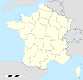
Matha Region Poitou-Charentes Département Charente-Maritime Arrondissement Saint-Jean-d'Angély Kanton Matha Gemeindeverband Communauté de communes du Pays de Matha Koordinaten 45° 52′ N, 0° 19′ W45.868333333333-0.31888888888889Koordinaten: 45° 52′ N, 0° 19′ W Höhe 23–68 m Fläche 19,08 km² Einwohner 2.167 (1. Jan. 2008) Bevölkerungsdichte 114 Einw./km² Postleitzahl 17160 INSEE-Code 17224 Matha ist eine französische Gemeinde im Département Charente-Maritime in der Region Poitou-Charentes; sie gehört zum Arrondissement Saint-Jean-d'Angély und zum Kanton Matha.
Bevölkerungsentwicklung
- 1962: 2134
- 1968: 2141
- 1975: 2252
- 1982: 2300
- 1990: 2183
- 1999: 2082
- 2006: 2107
Sehenswürdigkeiten
- Das Renaissance-Château de Matha, von dem nur noch das Torhaus steht (16. Jahrhundert, Monument historique)
- Die Kirche Saint-Hérie (12. Jahrhundert)
- Die Kirche Saint-Pierre im Ortsteil Marestay
-
Das Torhaus des Château de Matha (Monument historique)
Weblinks
Wikimedia Foundation.


